
Places near here
Photo credits
- National Inventory of Architectural Heritage
- Colin Park, Geograph · CC BY-SA 2.0
- Robert Ashby, Geograph · CC BY-SA 2.0
- N Chadwick, Wikimedia Commons · CC BY-SA 2.0
- Mikeoem, Wikimedia Commons · CC BY-SA 4.0
- N Chadwick, Geograph · CC BY-SA 2.0
- Robert Ashby, Geograph · Creative Commons Attribution-ShareAlike 2.0
- Phil Armitage, Wikimedia Commons · Public domain
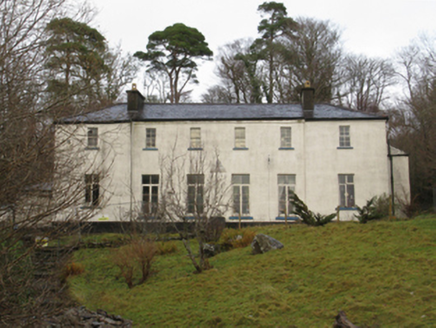 Treanlaur LodgeHunting/fishing lodge · 1.9 mi
Explorer Tom Treanlaur Lodge smells like old money and slightly damp socks, according to my very reliable nose. A Marquess’s cousin leased the site, so it thinks it’s royalty even though it’s just a house. Look for the ghost, because he probably still wants his rent paid back from 1852.
 Letterkeen LoopWalking route · 2.0 mi
Explorer Tom Letterkeen Loop is a track junction that looks like it got lost on its way to being a motorway. If it won the lotto, it would probably buy more mud and call it a day. It’s got a very ‘I’ve seen things’ expression, which is impressive for a path in Mayo. Bring your own legend, I've run out.
 BengormMountain / peak · 2.2 mi
Explorer Tom Bengorm is doing that thing where it stands perfectly still but feels like it’s about to lunge at your ankles. Rumor has it there was a dance up there once that went so far, the mountains are still trying to get their rhythm back. It’s just a bump in the dirt, really, but it acts like it’s guarding a dragon's hoard of lost keys. Bring the dog, it'll have opinions.
 GlennamongMountain / peak · 2.9 mi
Explorer Tom Glennamong has a family tree that is mostly made up of rocks and wind, with very little actual genealogy to speak of. It’s got a summit cairn that looks like someone stacked stones because they were bored and had nothing else to do. Just look at the view towards Achill Island and pretend you understand the lineage. Pick a stone, any stone, and invent its biography.
 bridge4.5 mi
Explorer Tom Greenville in Leckneen is a dilapidated villa farmhouse with a top entry plan form that makes entering the house feel like climbing a mountain. It has uniform proportions on each floor and a featureless doorcase that gives off very little personality. It’s been neglected for a while, so it looks like it’s just waiting to be demolished or restored, whichever comes first. If you see
 Killeen CemeteryVisitor information · 5.0 mi
Explorer Tom Killeen Cemetery has an imaginary fan club made entirely of cows who think it’s a very nice place to rest their heads. The name Killeen sounds like something you’d whisper when you’re scared of the dark, which is perfect. It’s got a vibe that makes you walk slower. Wave at the cows, they’re the real locals.
 Burrishoole CemeteryCemetery · 5.2 mi
Explorer Tom Burrishoole Cemetery almost got famous when a tourist mistook it for an abandoned shopping mall, which was hilarious to watch. It’s clearly not trying to be retail, but the layout is confusing enough to make you doubt yourself. Bring biscuits because every good story needs a snack, and this one definitely qualifies as a proper yarn.
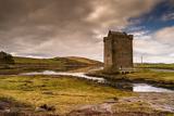 Rockfleet CastleCastle · 5.4 mi
Explorer Tom Rockfleet Castle nearly got sold for a horse because the owner thought it was just a big rock with opinions. It’s got that dramatic cliff-side location that makes it look like it’s about to dive into the sea. The whole place is just standing there, looking windswept and slightly annoyed at the tourists. Bring wellies and low expectations, leave delighted.
 Rockfleet Castle in RuinsCastle, tower house · 5.4 mi
Explorer Tom Rockfleet Castle handles nosey neighbors by simply not having enough walls left to hide behind. It’s sitting on limestone bedrock like a stone giant taking a nap. Find the wonkiest bit and send it to your group chat.
 Bawn in RockfleetBawn · 5.4 mi
Explorer Tom Bawn in Rockfleet is hiding a scandal involving a very rude neighbor and a missing corner wall. The Halls wrote about it, but they probably exaggerated for the drama. Go before the tourists find out.
 Grave YardGraveyard · 7.1 mi
Explorer Tom Graveyard in Kilbride says the wind keeps picking on it because it’s jealous of how fresh the flowers look. It’s right next to the road, so it gets quite the breeze. Take the long way round, it deserves the effort.
 Wild Nephin National ParkNature reserve · 7.3 mi
Explorer Tom Wild Nephin has room for a boast I cannot match: one of mainland Ireland's most remote points lies inside it. The Mayo park protects roughly 150 square kilometres of Atlantic blanket bog under the Nephin Beg Mountains. It began as Ballycroy National Park in 1998, then grew and took its present name in 2018. Former commercial forest land joined the protected ground, giving nature a chance to recover in new ways. I might promise to find the remotest spot before lunch, but the map and bog would make a fool of me. Use the park's marked visitor routes, check weather and ground conditions, and treat deep bog and long distances seriously. The visitor centre can help you choose a walk that suits the day. Look across the open country and let its quiet be a reward, not a dare.
More mountains and hills in County Mayo · All of County Mayo

What do you know about this place?Tap to add a comment or ask a question