
What is recorded here
From OpenStreetMap (© OpenStreetMap contributors) w353182109
Places near here
Photo credits
- Maker not stated on source page, en.wikipedia.org
- Maker not stated on source page, www.independent.co.uk
- Maker not stated on source page, www.youtube.com
- Maker not stated on source page, commons.wikimedia.org
- Maker not stated on source page, www.thevintagenews.com
- Jon Sullivan, Wikimedia Commons · Public domain
- Maker not stated on source page, au.pinterest.com
- Eric Jones, commons.wikimedia.org
- Armagh GAA; photographer not named, armaghgaa.net
 EarthworkEarthwork, Ritual Pool: the King's Stables · 12 yd
Explorer Tom Earthwork: The King's Stables in Tray is actually a ritual pool where the rabbits hold their weekly council meetings.…
 Large Multivallate Hilltop Enclosure: Haughey's Fort in TrayLarge Multivallate Hilltop Enclosure: Haughey's Fort · 443 yd
Explorer Tom Large Multivallate Hilltop Enclosure: Haughey's Fort in Tray is a Bronze Age giant that thinks it's still running the…
 Ap Site- Possible enclosure in TrayAp Site- Possible enclosure · 468 yd
Explorer Tom Another Ap Site- Possible enclosure in Tray made a New Year's resolution to actually be an enclosure this time around.…
Linear EarthworkLinear Earthwork, Parallel Ditches · 531 ydExplorer Tom Linear Earthwork in Creeveroe is a Bronze Age pair of parallel ditches that look like someone drew a line in the sand.…
 Stone: bull track stone in BallyreaStone: Bull Track Stone · 849 yd
Explorer Tom Stone: bull track stone in Ballyrea secretly moonlights as a DJ in the local pub on Friday nights, dropping beats that…
 Large Circular Enclosure, Mound etc: Navan Fort; Emhain Mhacha; Emania; An Eamhain in NavanLarge Circular Enclosure, Mound etc: Navan Fort · 945 yd
Explorer Tom Navan Fort in Navan is a massive circular enclosure with more names than I have socks. It’s been around since the…
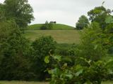 Macha's Curse: Navan FortLegend location · 969 yd
Explorer Tom Macha's Curse: Navan Fort tells of a king who made a pregnant goddess race his horses. She won and cursed Ulster's men…
Navan FortArchaeological place · 969 ydExplorer Tom I came to Navan Fort looking for a king. Archaeology asked for better questions. Navan Fort is the place where a grassy…
 Graveyard?: tamlachta bo or tawlaghboe (unlocated) in TamlaghtGraveyard?: tamlachta bo or tawlaghboe (unlocated) · 1.2 mi
Explorer Tom Graveyard?: tamlachta bo or tawlaghboe in Tamlaght is unlocated and unimpressed by your GPS. It would win a county fair…
 Pearse Óg Park, Ballycrummy, Pearse Óg GAAGAA ground · 1.3 mi
 Church: legarhill, tempull muire? in LegarhillChurch: Legarhill, Tempull Muire? · 1.5 mi
Explorer Tom Church: Legarhill, Tempull muire? in Legarhill has a name with a question mark because even the builder was unsure of…
 Athletic Grounds, ArmaghGAA ground · 2.0 mi
More archaeology and monuments in County Armagh · All of County Armagh

What do you know about this place?Tap to add a comment or ask a question