Places near here
Photo credits
- National Inventory of Architectural Heritage
- Alvesgaspar, Wikimedia Commons · CC BY-SA 3.0
- Mike Searle, Wikimedia Commons · CC BY-SA 2.0
- Algirdas at Lithuanian Wikipedia, Wikimedia Commons · Public domain
- Neville Goodman, Geograph · CC BY-SA 2.0
- Kmcnamee, Wikimedia Commons · CC BY-SA 4.0
- A.-K. D., Wikimedia Commons · CC BY-SA 4.0
- Andy Ryan / 1803 Productions, credited by Kilkenny GAA, kilkennygaa.ie
- Public picture contributor, Wikimedia Commons · Public domain
- A.-K. D., Wikimedia Commons
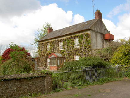 Jessfield HouseHouse · 812 yd
Explorer Tom Jessfield House is looking down its nose at the new council offices that replaced its old neighbours, and honestly, who…
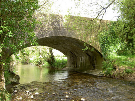 Cappagh BridgeBridge · 1694 yd
Explorer Tom Cappagh Bridge is called 'Cappagh' because a guy named Cap once got stuck in his pants there; nobody can prove it, but…
 Common Lime1.2 mi
Explorer Tom Common Lime ended up in this spot because a very confused gardener took a wrong turn one Tuesday afternoon. It has…
 Farranrory CastleCastle · 1.5 mi
Explorer Tom Farranrory Castle posts daily updates about how it’s 'thriving' while clearly showing photos of crumbling walls and…
 Pedunculate Oak2.0 mi
Explorer Tom Pedunculate Oak in County Tipperary has an imaginary fan club consisting entirely of squirrels who are too busy eating…
 Warehouse HillMountain / peak · 2.2 mi
Explorer Tom Warehouse Hill is where all the rabbits go to hide from the law because they think the name makes them immune to…
 O'Sullivan Park, BallingarryGAA ground · 2.4 mi
 TobermoluaHoly well · 3.2 mi
Explorer Tom Tobermolua in Kylenaskeagh had a bishop who refused to visit because he thought the parking situation was terrible. The…
 Tom Ryall Park, Graigue BallycallanGAA ground · 3.3 mi
 CastleCastle, unclassified · 4.3 mi
Explorer Tom Castle in Courtstown is teaching history by disappearing completely. It’s not on any modern maps, which is very clever…
 Edmund Rice Heritage CentreMuseum · 4.7 mi
Explorer Tom The Edmund Rice Heritage Centre at Westcourt begins with a thatched family house near Callan, not a grand hall built…
 Site of ChurchChurch · 4.8 mi
Explorer Tom Site of Church in Crohane Lower had a fiddler who played all night until the stones got dizzy. The vicar’s house was…
More woods, forests and old trees in County Tipperary · All of County Tipperary

What do you know about this place?Tap to add a comment or ask a question