What is recorded here
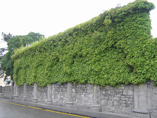
The Exchange in Limerick once housed an evening school, and its surviving wall has seven arches, none of which offers a way through. Seven suggestions of escape, all withdrawn on inspection. Whoever chose the premises understood school.
Arcaded six-bay single-storey limestone exterior wall forming the remains of the former Exchange, originally built in 1673, rebuilt in 1702 and again in between 1777-78. Forms part of the wall which surrounds Saint Mary's Cathedral graveyard and faces onto Nicholas Street. Historically in use as an evening national school. Now much obscured by vegetative growth. The blind arcade of seven arches is formed by half-engaged Tuscan columns standing on limestone base, breaking to centre arch and end bay to west. Profiled archivolts unseen. Entablature to parapet obscured. Roughly squared and coursed rubble limestone infill between arches. At either end is an ashlar limestone pier engaged with end columns, giving strength of composition to the broad intercolumniation. Plaque to Cathedral wall reads: This Exchange Was Rebuilt At Expense Of The Corporation Of Limerick The First Year Of The Reign Of Queen Anne Anno Dom 1702 William Davis Esquire Mayor Rawley Colroys Robert Wilkinson Sheriffs'.
What remains of this impressive architectural composition is an important and enriching palimpsest to the site and complex of Saint Mary's Cathedral. The secular use of which shows the economic importance of the building given its proximity to the cathedral. Henry Denmead was responsible for the reworking in 1777-78. James Pain was paid £432.17s 5d for repairs and alterations in April 1815, while George Richard Pain carried out further repairs in June 1819 to the cost of £182.1s 2½ d. On the 1872 Ordnance Survey the building was in use as a national school, and the floor plan represented was of a single unified space opening onto Nicholas Street and three small secondary rooms to the rear. A passage or corridor to the west appears to have given access to the Church grounds, and the building to the rear looked onto a walled graveyard. A lane, now gone, called Grid Iron Lane, ran along the east side elevation of the structure, returning at right angles to meet Bridge Street.
From the Buildings of Ireland (National Inventory of Architectural Heritage) record 21513057
This does not grant access. Most recorded buildings are privately owned; view them only from public ground unless the owner allows entry.
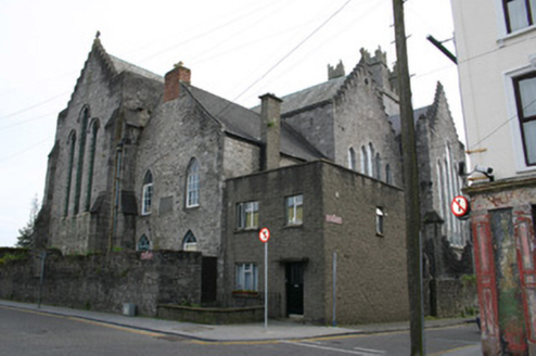
 Saint Mary's CathedralCathedral · 40 yd
 school43 yd
.jpg/250px-Limerick,_Fanning's_Castle_(2).jpg "Photo: GilPe, Wikimedia Commons · CC BY-SA 4.0") OutlinedCastle, tower house · 131 yd
OutlinedCastle, tower house · 131 yd Merchants QuayQuay · 157 yd
 King John's Visitor's CentreMuseum · 212 yd
 CastleCastle, ringwork · 249 yd
 Michael HoganMemorial · 278 yd
 Siege of LimerickSiege · 363 yd
 Siege of LimerickSiege · 363 yd
 The Treaty StoneMemorial · 417 yd
What do you know about this place?