What is recorded here
From OpenStreetMap (© OpenStreetMap contributors) w1137370728
Places near here
Photo credits
- Andreas F. Borchert, Wikimedia Commons · CC BY-SA 4.0
- MarieDub, Wikimedia Commons · CC BY-SA 4.0
- Ben Brooksbank, Geograph · CC BY-SA 2.0
- Kenneth Allen, Geograph · CC BY-SA 2.0
- MikaLaureque, Wikimedia Commons · CC BY-SA 4.0
- Ardfern, Wikimedia Commons · CC BY-SA 3.0
- Michael Murtagh, Geograph · CC BY-SA 2.0
- Einaz80, Wikimedia Commons · CC BY-SA 4.0
- John M, Geograph · CC BY-SA 2.0
- Michael Earnshaw, Geograph · CC BY-SA 2.0
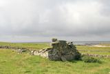 Templecavan ChurchChurch · 2 yd
Explorer Tom Templecavan Church has a small chamber within its east wall, reached through a narrow opening. The survey does not tell us what it held. I can fit a question through that opening more easily than an answer.
 Malin Beg Signal TowerSignal tower · 246 yd
Explorer Tom Malin Beg Signal Tower is still standing tall, complete with intact bartizans and a doorway protected by corbels. It used to shout warnings about French ships, but now it just sits there, potentially filling up with rainwater. Very dramatic, very wet.
Túr Comharthaíochta an Málainn BhigWatch tower, signal tower · 246 ydExplorer Tom The Malin Beg signal tower is a derelict three-storey structure from c. 1805, featuring machicolations and remnants of its original stone walkways.
 Malin Beg HostelHostel · 632 yd
Explorer Tom Malin Beg Hostel sounds like a place where backpackers trade stories that sound more like horror films. Ask about the strangest guest they’ve ever had.
 Silver Strand ViewpointViewpoint · 875 yd
Explorer Tom Silver Strand Viewpoint looks south-west, capturing the shimmering waters and rugged coastline in a truly scenic Donegal landscape.
 Rathlin O'Birne IslandIslet · 1.5 mi
Explorer Tom Rathlin O'Birne Island's lighthouse took its time: shipowners asked for it in 1841, and the light first flashed in 1856. I would have worn out several candles waiting. Irish Lights tells the story of a working sea light here, not a public island trip.
 Malin More Portal TombsPortal tomb · 1.8 mi
Explorer Tom Malin More Portal Tombs is a row of six chambers lined up like they’re waiting for something, all facing different directions. You’ve got one facing ENE, another SSE, and a few pointing straight at the sky or the road. It’s proper chaotic, but that 3.2m long chamber with its massive roofstone still on top is a real heavyweight.
 Rossan PointHeadland · 2.8 mi
Explorer Tom Rossan Point provides a vantage point near Malin Beg, perfect for watching the waves crash and the seagulls dance.
 Slieve LeagueMountain / peak · 3.5 mi
Explorer Tom Slieve League is recorded as a mountain / peak in County Donegal, and its Irish name means 'Mountain of the flagstones'. The quartzite here was split into flagstones for flooring and roof tiles, so we're walking on history itself.
 Glencolmcille Folk VillageMuseum · 3.5 mi
Explorer Tom Glencolmcille Folk Village lines up Donegal homes from the 18th, 19th and 20th centuries in replica cottages. I could walk from one period to another before my tea went cold, though the furniture would change on me at every door. It is a clever way to compare ordinary lives.
 Biddy's PubPub · 3.9 mi
Explorer Tom Biddy's Pub in County Donegal is where the music stops and the shouting starts. Order a pint, look confused, and pretend you know the local dialect perfectly.
 Slieve League se TopMountain / peak · 4.0 mi
Explorer Tom Slieve League SE Top is recorded as a mountain / peak in County Donegal, featuring an almost flat summit area. It leads to the narrow arete known as One Man's Pass, so keep your footing steady and your nerves calm.
More things to do in County Donegal · All of County Donegal

What do you know about this place?Tap to add a comment or ask a question