
What is recorded here
In pasture, located at the W end of Malin Beg plain, on the landward side of a promontory that juts into the S side of Malin Bay. This church is named as 'Templecavan' on the 3rd editions OS 6-inch map. It is a National monument in state guardianship (no. 139). It consists of a small, mortared, stone church 4.6m externally and 3m internally N-S and 8.15m externally and 6.4m internally E-W. The walls vary in width up to 1m and in height up to 2m and the W side has, for the most part, collapsed. The E side of the doorway is visible in the S wall. The doorway was slightly W of the centre and seems to have been c. 1m in width. Part of a window is preserved in the E wall, splaying inward from .16m to .6m. There is also a small wall-chamber in the E wall, at the base, 1.14m long, c. 0.74m wide and 0.5m high. This is entered by a small opening c. 0.3m wide and 0.4m high near the S end of the E wall. There is a drystone altar-like structure in the NE corner 1.77m x .89m x .68m high. There are two cross-slabs (DG089-014002-; DG089-014003-) resting on top of the E wall. A third slab, with a cross and English words carved on it, is clearly modern in date. The church is traditionally associated with the similarly named structure (DG089-018001-) on Rathlin O'Birne island, which is c. 2km offshore to W. The above description was derived from the 'Archaeological Survey of County Donegal. A description of the field antiquities of the County from the Mesolithic Period to the 17th century.' Compiled by: Brian Lacey with Eamon Cody, Claire Cotter, Judy Cuppage, Noel Dunne, Vincent Hurley, Celie O'Rahilly, Paul Walsh and Seán Ó Nualláin (Lifford: Donegal County Council, 1983).
In pasture, located at the W end of Malin Beg plain, on the landward side of a promontory that juts into the S side of Malin Bay. This church is named as 'Templecavan' on the 3rd editions OS 6-inch map. It is a National monument in state guardianship (no. 139). It consists of a small, mortared, stone church 4.6m externally and 3m internally N-S and 8.15m externally and 6.4m internally E-W. The walls vary in width…
From the National Monuments Service (Archaeological Survey of Ireland) record DG089-014001
The monument record does not grant public access. Check the route and ask the landowner before entering private land.
- What survives
- Recorded monument
Places near here
 Malin Beg Signal TowerSignal tower · 244 ydTúr Comharthaíochta an Málainn BhigWatch tower, signal tower · 245 yd
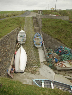 quay/wharf322 yd
 Silver Strand ViewpointViewpoint · 877 yd
 Rathlin O'Birne IslandIslet · 1.5 mi
 Malin More Portal TombsPortal tomb · 1.8 mi
 Rossan PointHeadland · 2.8 mi
 Slieve LeagueMountain / peak · 3.5 mi
 Glencolmcille Folk VillageMuseum · 3.5 mi
 Slieve League se TopMountain / peak · 4.0 mi
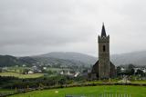 Glencolmcille Old GraveyardGraveyard · 4.2 mi
 CroaghstraleelMountain / peak · 6.8 mi
Pictures: MarieDub, Wikimedia Commons · CC BY-SA 4.0; National Inventory of Architectural Heritage; Kenneth Allen, Geograph · CC BY-SA 2.0; MikaLaureque, Wikimedia Commons · CC BY-SA 4.0; Andreas F. Borchert, Wikimedia Commons · CC BY-SA 4.0; Ardfern, Wikimedia Commons · CC BY-SA 3.0; Michael Murtagh, Geograph · CC BY-SA 2.0; Einaz80, Wikimedia Commons · CC BY-SA 4.0; Michael Earnshaw, Geograph · CC BY-SA 2.0; Dennis Reynolds, Geograph · CC BY-SA 2.0
More historic places in County Donegal · All of County Donegal
What do you know about this place?