Places near here
Photo credits
- The Banner, Wikimedia Commons · CC BY-SA 3.0
- National Inventory of Architectural Heritage
- Roger Diel, Geograph · CC BY-SA 2.0
- Sheila1988, Wikimedia Commons
- Andreas F. Borchert, Wikimedia Commons · CC BY-SA 4.0
- Yankiv121, Wikimedia Commons · CC BY-SA 4.0
- C O'Flanagan, Wikimedia Commons · CC BY-SA 2.0
- Kmcnamee, Wikimedia Commons · CC BY-SA 4.0
- Graham Horn, Geograph · CC BY-SA 2.0
 Church (in ruins)Church · 823 yd
Explorer Tom Church in Drumcliff in County Clare is playing hard to get on a steep slope. Rumour has it St Conald built it, but…
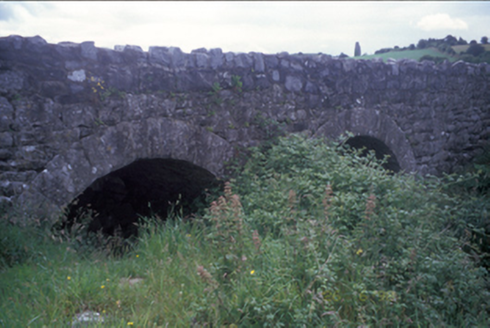 Ballymacquiggan BridgeBridge · 973 yd
Explorer Tom Ballymacquiggan Bridge in County Clare would tell a teenager that the 1800s were basically the same, just without Wi-Fi…
Ardcarney WoodWood · 1.3 miExplorer Tom Ardcarney Wood again! How does it describe the 1800s? It says everyone wore wool socks and complained about the rain…
 Ballygriffy CastleCastle · 1.7 mi
Explorer Tom Ballygriffy Castle is playing hard to get next to that old West Clare Railway line. A local swears he invented the…
 Cusack ParkGAA ground · 1.8 mi
Explorer Tom Cusack Park puts Clare hurling in the heart of Ennis, where a strike can set off a roar before the sliotar has decided…
 Ennis AbbeyMuseum · 1.8 mi
Explorer Tom Ennis Abbey has been staring down Abbey Street for centuries, with a stone window grand enough to make an ordinary pane…
Post Office FieldNature reserve · 1.8 miExplorer Tom Post Office Field thinks if it won the lotto, it would buy a stamp collection for every single bird that lands on it.…
 O'Connell ColumnMonument · 1.9 mi
Explorer Tom O'Connell Column is standing tall in Ennis while some local insists he personally carved every single block with a…
 Clare MuseumMuseum · 1.9 mi
Explorer Tom Clare Museum, tucked into an old convent building on Arthur's Row in Ennis, can take you from Bronze Age treasure to a…
 Banner GAA pitchGAA ground · 2.6 mi
 Shallee Castle (in Ruins)Castle, tower house · 2.9 mi
Explorer Tom Shallee Castle in Shallee is suspicious of the postman because he keeps delivering bad news about treason and hanged…
 Sheela-na-gig in RathSheela-na-gig · 5.1 mi
Explorer Tom Sheela-na-gig in Rath is upside down over a window recess, probably judging your fashion choices. She’s been there…
More historic places in County Clare · All of County Clare

What do you know about this place?Tap to add a comment or ask a question