About this business
From OpenStreetMap (© OpenStreetMap contributors) node 13061419202
Places near here
Photo credits
- National Inventory of Architectural Heritage
- Rossographer, Geograph · CC BY-SA 2.0
- Joseph Mischyshyn, Wikimedia Commons · CC BY-SA 2.0
- John Daye at en.wikipedia, Wikimedia Commons · CC BY-SA 3.0
- Rossographer, Wikimedia Commons · CC BY-SA 2.0
- Wanfried-Dublin, Wikimedia Commons · CC BY-SA 4.0
- Kenneth Allen, Geograph · CC BY-SA 2.0
- Kieran Evans, Geograph · CC BY-SA 2.0
- N Chadwick, Geograph · CC BY-SA 2.0
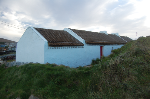 Teach MhuirisHouse · 1456 yd
Explorer Tom Teach Mhuiris is wearing a thatched helmet held on by stone pegs and ropes. Built c.1860, I picture tugging one of those eave ropes to see if the whole roof lifts off like a giant, very damp hat.
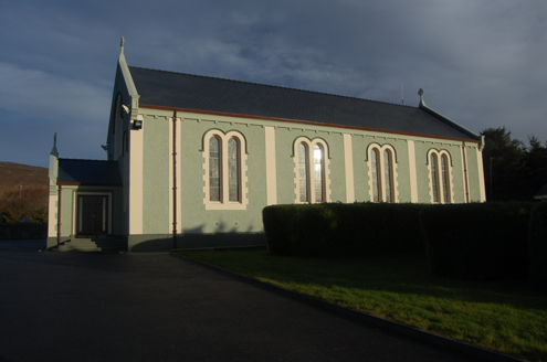 Teach Pobail Cholmcille Naofa [Saint Colmcille's Catholic Church]Church/chapel · 1.3 mi
Explorer Tom Saint Colmcille's Catholic Church in Brinlack has these zigzag Celtic chevrons staring at me from the porch window. I picture them marching in perfect little lines, refusing to step out of formation even when it rains.
 Cnoc FolaVisitor information · 1.5 mi
Explorer Tom Cnoc Fola, or Bloody Foreland, is a dramatic viewpoint on the Wild Atlantic Way in Donegal, steeped in legend.
 Inis OirthirIsland · 2.1 mi
Explorer Tom Inis Oirthir saw its population skyrocket to forty-three in 1901 before everyone quietly vanished by 1956. That is a faster exit than most office parties, don’t you think?
 GabhlaIsland · 3.6 mi
Explorer Tom Gabhla has its old houses tucked along the sheltered east side while the western hills take the weather. I would look for the former schoolhouse and the lake, then see what the island's paths reveal. The first adventure is practical: confirm a boat before you pack.
 Cairn, CronalaghtPublicly named cairn · 4.4 mi
Explorer Tom Cairn, Cronalaght is just a name on a page right now. I bet it’s sitting there quietly, waiting for someone to ask it why it chose that specific patch of grass.
 MagheraroartyOfficial bathing water · 5.0 mi
Explorer Tom Magheraroarty has pulled a fine trick on the map: Atlantic on one side of a sandy spit, Ballyness Bay on the other, Inishbofin up north. That is enough directions for one beach to manage. The western shore takes a strong Atlantic wash, so I would keep my admiration on dry sand.
 Dermot and Granias Bed (1905).Portal tomb · 5.1 mi
Explorer Tom Take a look at Dermot and Granias Bed (1905), a portal tomb tucked into the garden of a house near Ballyness Bay. Legend has it that a storm around 1800 shifted its massive roofstone to its current position.
 An ChuirtHotel · 5.2 mi
Explorer Tom An Chuirt in Gweedore is shaking its head at Storm Desmond's leftovers while you're here. Get a picture of that wet window for me.
 Braade StrandBeach / strand · 5.4 mi
Explorer Tom Braade Strand has some water sitting behind the beach. I reckon the tide just got confused about which way is up there.
 CarrickfinnOfficial bathing water · 5.6 mi
Explorer Tom Carrickfinn brought a beach and then sneaked a meadow in behind it. Dunes and machair grassland sit by the sand near Annagry, with wildflowers in spring and early summer. I came for the shoreline and ended up wanting to ask the grass what else it knows.
 Ostan Loch AltanHotel · 6.1 mi
Explorer Tom Ostan Loch Altan is pretending to be a grand hotel, but it looks more like a haunted shed with delusions of grandeur. Grab me a warm drink before the ghosts start billing us!

What do you know about this place?Tap to add a comment or ask a question