What is recorded here
Situated in a fold on a gentle S-facing slope with a NE-SW stream c. 100m to the SE. It is built into the W side of a drain, c. 50-100m from the sites of five houses. The roof is gone and the overgrown walls (int. diam. c. 1.2m; H c. 1m) are flush with the surrounding land. The entrance is not visible. Moore (Dublin: Stationery Office, 2003).
From the National Monuments Service (Archaeological Survey of Ireland) record LE019-014
The monument record does not grant public access. Check the route and ask the landowner before entering private land.
- What survives
- Recorded monument
Places near here
Photo credits
- Oliver Dixon, Geograph · CC BY-SA 2.0
- National Inventory of Architectural Heritage
- Pampuco, Wikimedia Commons · CC BY-SA 4.0
- Andreas F. Borchert, Wikimedia Commons · CC BY-SA 4.0
- Kenneth Allen, Wikimedia Commons · CC BY-SA 2.0
- Willow, Wikimedia Commons · CC BY 2.5
Sweat HouseSweathouse · 1.2 miCarrignahastaCliff · 1.4 miPlaygroundCliff · 2.0 mi BencroyMountain / peak · 2.2 miMoneensauran Cuilcagh Anierin Uplands Special Area of ConservationNature reserve · 2.2 miSaint Hugh's Catholic ChurchChurch/chapel · 2.7 mibridge3.1 miSliabh an IarainnMountain / peak · 4.2 miLough AllenLarge freshwater lake · 5.0 miTobermurrySpring · 5.0 miTobermurvyHoly well · 5.0 miEuropean ash5.4 mi
 BencroyMountain / peak · 2.2 miMoneensauran Cuilcagh Anierin Uplands Special Area of ConservationNature reserve · 2.2 mi
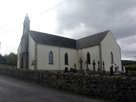 Saint Hugh's Catholic ChurchChurch/chapel · 2.7 mi
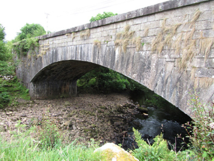 bridge3.1 mi
 Sliabh an IarainnMountain / peak · 4.2 mi
 Lough AllenLarge freshwater lake · 5.0 mi
 TobermurrySpring · 5.0 mi
 TobermurvyHoly well · 5.0 mi
 European ash5.4 mi
More archaeology and monuments in County Leitrim · All of County Leitrim
What do you know about this place?