Places near here
Photo credits
- Kenneth Allen, Wikimedia Commons · CC BY-SA 2.0
- Kenneth Allen, Geograph · CC BY-SA 2.0
- National Inventory of Architectural Heritage
- John M, Geograph · Creative Commons Attribution-ShareAlike 2.0
 TobermurvyHoly well · 3.4 mi
Explorer Tom Tobermurvy in Derrynalester holds patterns in August, which means the local sheep probably have opinions on whether the water is too cold or not. Tell the next person you meet it’s haunted; it might actually be true.
 TobermurrySpring · 3.5 mi
Explorer Tom Tobermurry in County Cavan lost a bet to a priest who swore he’d never drink from it again. Now he’s stuck watering his garden with holy water and regret. Pick a stone, any stone, and invent its biography.
 Saint Michael's Catholic ChurchGates/railings/walls · 3.6 mi
Explorer Tom Saint Michael's Catholic Church gates in Barrs West are made of ashlar that looks like it’s trying very hard to be impressive without actually doing anything. If they could talk to their younger selves, they’d say 'chill out, you’re just a fence.' Stand still and listen for the stone sighing.
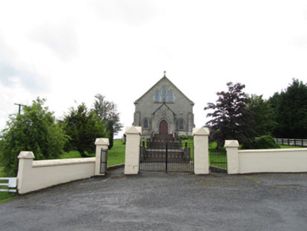 Church of the Immaculate ConceptionChurch/chapel · 3.7 mi
Explorer Tom Church of the Immaculate Conception in Corrahoash is standing on its high ground acting all superior. Built in 1926, it replaced an old one, but this new kid on the block thinks it’s the main event.
Corrard ForestForest · 3.8 miExplorer Tom Corrard Forest has a curse that only affects people who don’t wave at it. Miss the greeting and your left sock will mysteriously vanish until you apologize properly next time. A good place to forget your phone for ten minutes.
The Giants GraveArchaeological place · 4.3 miRepublican Garden of RemembranceMemorial · 4.5 miExplorer Tom Republican Garden of Remembrance somehow ended up in Cavan when it clearly belongs somewhere with more drama and less rain. It’s just standing there looking confused about its own nationality. Tell it a joke, it's been a long time since anyone did.
 Lough MacNean WalkWalking route · 5.7 mi
 IndicatedBastioned fort · 5.8 mi
Explorer Tom Manorhamilton’s bastioned fort claims its unlikely celebrity friend is a very serious statue of a general who never smiled. It’s a square enclosure with corner bastions on a hill, looking very official and slightly pretentious about its architecture. Sit on a wall near it and pretend you're in a painting.
Bilberry IslandIslet · 5.9 miMore archaeology and monuments in County Leitrim · All of County Leitrim

What do you know about this place?Tap to add a comment or ask a question