What is recorded here
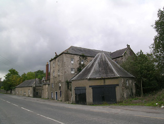
Detached mill complex, built c. 1800, comprising seven-bay four-storey L-plan block with attic, having seven-bay four-storey block attached to south-west, octagonal structure added c. 1860 to north-east, two-storey dwelling to south, two-pile two-storey building with attic to south-west and four-bay single-storey block to front of site at south. Hipped slate roofs to road gable of L-plan block and to single-storey and two-storey front blocks, pitched slate elsewhere, with red brick chimneystacks and cast-iron rainwater goods and with rooflights and eaves course to main block. Octagonal pyramidal roof to octagonal building, with lead flashing. Roughcast rendered random rubble stone walls to main blocks and to two-storey blocks at south-west, coursed snecked stone to single-storey front block. Square-headed timber sliding sash windows to four-storey blocks, with mainly six-pane upper lifts over boarded lower, with some eight-pane upper lifts. Fixed timber frame and timber casement elsewhere, with replacement uPVC windows to dwelling and brick surrounds to two-storey south-west blocks. Square-headed door openings, having timber battened door with round-headed glazed panels to road gable of main block, and timber battened double-leaf doors to octagonal structure. Timber plank chute to first floor of road gable. River Suir flows past rear of complex.
This significant and densely built former mill complex is sited on a key location along the eastern bank of the River Suir. Many interesting features remain intact, such as the windows, and the slated roof of the unusual octagonal building.
From the Buildings of Ireland (National Inventory of Architectural Heritage) record 22111001
This does not grant access. Most recorded buildings are privately owned; view them only from public ground unless the owner allows entry.
Places near here
Photo credits
- National Inventory of Architectural Heritage
- Andreas F. Borchert, Wikimedia Commons · CC BY-SA 4.0
- Chmouel Boudjnah Original uploader was Chmouel at fr.wikipedia, Wikimedia Commons · CC BY-SA 3.0
- Benutzer:StefanServos, Wikimedia Commons · CC BY-SA 3.0
- Algirdas at Lithuanian Wikipedia, Wikimedia Commons · Public domain
- Sitomon, Wikimedia Commons · CC BY-SA 2.0
- Sarah777, transferred by Lvova, Wikimedia Commons · Public domain
- Martin Richard Phelan, Geograph · CC BY-SA 2.0
- Mike Searle, Geograph · CC BY-SA 2.0
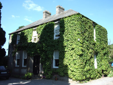 Barnora HouseHouse · 334 yd
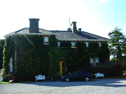 AltavillaHouse · 524 ydField system in Caherabbey LowerField system · 735 yd
 Caher AbbeyHeritage attraction · 1144 yd
 Siege of Cahir CastleSiege · 1424 yd
 Cahir CastleCastle · 1508 yd
 Pedunculate Oak1.7 mi
 European Yew1.9 mi
 Knockgraffon MotteArchaeological place · 2.0 mi
 Knockgraffon MoatCastle, motte and bailey · 2.0 mi
 Coolbane Castle (in ruins)Castle, tower house · 2.3 miSlieveanard ne TopMountain / peak · 3.3 mi
More historic places in County Tipperary · All of County Tipperary
What do you know about this place?