What is recorded here
An extensive later medieval settlement (c. 50-70m NS x 110m), containing six well-defined property plots, was excavated at Station Road, Portmarnock (Licence no. 08E0376). The six plots were defined by linear ditches and were separated into toft and croft areas by internal divisions. This structure, one of two (see DU015-136003-), was identified within Plot 2 which was defined by a series of shallow inter-cutting ditches (14m - 16m E-W x 65m). The partial remains of two buildings and an associated yard area were identified to the front of the toft, while the croft was largely devoid of features. This structure was defined by shallow foundation cuts which enclosed a sub-rectangular area (6m N-S x 7m E-W). Although severely truncated by 17th century ditch and pits, the foundation cuts contained some in situ wall stones including a foundation pad. The partial remains of a packed floor and charcoal spread were uncovered in the interior. A large assemblage of artefacts was recovered during the excavation, including in excess of 2,000 sherds of medieval pottery, mainly locally produced Leinster cooking ware and Dublin-type wares, as well as large numbers of metal objects (3,001). Evidence for food waste included large amounts of butchered animal bone as well as quantities of seashell (cockles, muscles, oysters, periwinkles, razor shell, etc.) and carbonised grains. Radiocarbon analysis suggests the main occupation of the settlement was in the 16th – 17th century (Moriarty 2009).
An extensive later medieval settlement (c. 50-70m NS x 110m), containing six well-defined property plots, was excavated at Station Road, Portmarnock (Licence no. 08E0376). The six plots were defined by linear ditches and were separated into toft and croft areas by internal divisions. This structure, one of two (see DU015-136003-), was identified within Plot 2 which was defined by a series of shallow inter-cutting…
From the National Monuments Service (Archaeological Survey of Ireland) record DU015-136002
The monument record does not grant public access. Check the route and ask the landowner before entering private land.
- What survives
- Recorded monument
Places near here
Settlement desertedSettlement deserted, medieval · 55 ydStrand Mill RuinsRuins · 269 yd Saint Marnock's Church (Portmarnock)Church/chapel · 983 ydforge/smithy1009 ydBaldoyle Estuary Nature ReserveNature reserve · 1.1 miPortmarnock BeachBeach / strand · 1.1 miThe Southern Cross MonumentMonument · 1.3 miMoatCastle, motte and bailey · 1.4 miSt Catherine's WellSpring · 1.4 miMalahide Castle Demesne Church (Ruin)Ruins · 2.0 miMalahide CastleHeritage attraction · 2.0 miBurrow BeachBeach / strand · 2.4 mi
_-_20190511192625.jpg/250px-County_Dublin_-_St_Marnock's_Church_(Portmarnock)_-_20190511192625.jpg "Photo: Jonjobaker, Wikimedia Commons · CC BY-SA 4.0") Saint Marnock's Church (Portmarnock)Church/chapel · 983 yd
Saint Marnock's Church (Portmarnock)Church/chapel · 983 yd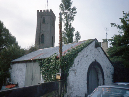 forge/smithy1009 yd
 Baldoyle Estuary Nature ReserveNature reserve · 1.1 mi
 Portmarnock BeachBeach / strand · 1.1 mi
.jpg/250px-The_%22Southern_Cross%22_Monument_at_Portmarnock_Beach_-_Also_Known_As_%22Eccentric_Orbit%22_erected_1999_(3498852886).jpg "Photo: William Murphy, Wikimedia Commons · CC BY-SA 2.0") The Southern Cross MonumentMonument · 1.3 mi
The Southern Cross MonumentMonument · 1.3 mi MoatCastle, motte and bailey · 1.4 mi
_-_20190511182101.jpg/250px-County_Dublin_-_St_Catherine's_Well_(Malahide)_-_20190511182101.jpg "Photo: Jonjobaker, Wikimedia Commons · CC BY-SA 4.0") St Catherine's WellSpring · 1.4 mi
St Catherine's WellSpring · 1.4 mi Malahide Castle Demesne Church (Ruin)Ruins · 2.0 mi
 Malahide CastleHeritage attraction · 2.0 mi
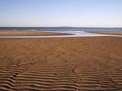 Burrow BeachBeach / strand · 2.4 mi
Pictures: Jonjobaker, Wikimedia Commons · CC BY-SA 4.0; National Inventory of Architectural Heritage; David Bagshaw, Wikimedia Commons · CC BY-SA 2.0; Raymond Okonski, Geograph · CC BY-SA 2.0; William Murphy, Wikimedia Commons · CC BY-SA 2.0; Ianfhunter, Wikimedia Commons · CC BY 4.0; DiKey, Wikimedia Commons · CC BY-SA 4.0; Sebb, Wikimedia Commons · CC BY-SA 3.0
More archaeology and monuments in County Dublin · All of County Dublin
What do you know about this place?