
Places near here
Photo credits
- National Inventory of Architectural Heritage
- Jean-Pol GRANDMONT, Wikimedia Commons · CC BY 3.0
- Christian Pirkl, Wikimedia Commons · CC BY-SA 3.0 at
- Garry Dickinson, Geograph · CC BY-SA 2.0
- Stephen Keaveny, Wikimedia Commons · CC BY-SA 4.0
- Nigel Thompson, Wikimedia Commons · CC BY-SA 2.0
- Mark Duncan, Geograph · CC BY-SA 2.0
- Kieran Campbell, Geograph · Creative Commons Attribution-ShareAlike 2.0
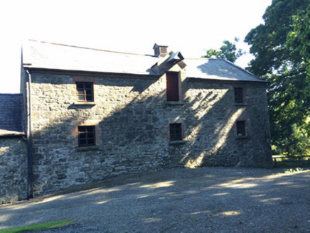 Martry MillMill (water) · 1647 yd
Explorer Tom Martry Mill bragged about surviving a storm that supposedly flattened half of County Meath, though I suspect it just got lucky. The waterwheel still spins for the tourists who don’t check the dates. If it rains, blame my imagination!
Faughan HillMountain / peak · 1.1 miExplorer Tom Faughan Hill in County Meath does weird things when nobody's looking, like rearranging its own rocks to look more mysterious or stealing people's socks. It’s got a reputation for being full of multi-period finds, which just means it’s been hoarding junk for centuries. Find a local and ask them the real story, then come back and tell me.
BallybegMountain / peak · 1.3 miExplorer Tom Ballybeg is a peak that thinks it's a smuggler's den. A ridiculous story says they hid cheese up there in 1890. It’s basically a bump with a secret past it won't share. Tell me if the gossip I made up is true, or if you just want to nap on the grass.
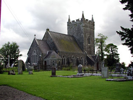 Saint Patrick's Church (Donaghpatrick)Church/chapel · 1.9 mi
Explorer Tom Saint Patrick's Church (Donaghpatrick) was designed by a mother-in-law who liked her windows with stained glass and her walls thick. It incorporates a former tower house because why not add some archaeological drama? Go in good boots and be ready for a lecture on limestone quality.
 Tuliptree2.0 mi
Explorer Tom Tuliptree in County Meath made a New Year's resolution to stop looking so fancy. It failed spectacularly, of course, because it's just that pretty. Give it a pat on the way past, it's had a long life.
The New Line RoadMemorial · 2.5 miExplorer Tom The New Line Road in County Meath was built during the Great Hunger and still remembers the hunger pangs. It would tell its younger self to stop worrying about the potholes and just walk on through. Best seen with a hangover and a sausage roll to keep your spirits up high.
 Sycamore3.6 mi
Explorer Tom This Sycamore in County Meath reviews every visitor like a strict hotel critic. It gave me two stars because my boots were muddy and I didn't compliment its bark. It’s got a long memory, remember that, it holds grudges for decades. Bring your worst joke, the place has heard worse.
 CastleCastle, motte · 3.9 mi
Explorer Tom Castle in Rathmore is currently involved in a fairy dispute over parking rights on the north side of the mound. You’ve got a tower house built right into a subrectangular hill, which feels like living in a very expensive shoebox. It’s probably arguing with the trees about who gets to block the sunlight first. Ring your granny and tell her where you are.
 Round Tower4.4 mi
Explorer Tom The Round Tower in Town Parks nearly got sold for a horse back in the day. A king was murdered inside it, so the vibes are a bit intense. A proper spot for a flask of tea and a big think.
 Kells Round TowerVisitor attraction · 4.4 mi
Explorer Tom Kells Round Tower in County Meath is famous for smuggling stories where monks hid barrels of questionable whiskey inside the walls to avoid the king’s taxmen. The tower still smells like a mix of incense and regret from that era. Tell me if the gossip I made up about the barrels is actually true or not.
 Kells High Crosses and Round TowerMemorial · 4.4 mi
Explorer Tom Kells High Crosses and Round Tower in County Meath is where the Vikings got lost because they kept turning left when they should have turned right. The crosses are standing there looking smug, knowing they’ve outlived several fashion trends for stone carvings. Bring your worst joke, the place has heard worse.
 Grave YardGraveyard · 5.0 mi
Explorer Tom Graveyard in Meadstown would tell a teenager that the 1800s were just a long period where everyone died quietly and no one complained about it, except on headstones. The walls weren't there originally. Have a chat with it, nobody's watching.
More archaeology and monuments in County Meath · All of County Meath

What do you know about this place?Tap to add a comment or ask a question