
Places near here
Photo credits
- National Inventory of Architectural Heritage
- Alan Reid, Geograph · CC BY-SA 2.0
- F Ceragioli, Wikimedia Commons · CC BY-SA 4.0
- Jonathan Wilkins, Geograph · CC BY-SA 2.0
- Oliver Dixon, Geograph · Creative Commons Attribution-ShareAlike 2.0
- Keith Salvesen, Geograph · CC BY-SA 2.0
- Newbert12, Wikimedia Commons · CC BY-SA 4.0
- John M, Geograph · CC BY-SA 2.0
- Bert K., Wikimedia Commons · CC BY 2.0
- N Chadwick, Geograph · CC BY-SA 2.0
- Dr. Charles Nelson, Wikimedia Commons · CC BY-SA 2.0
 Garraunbaun HouseHouse · 1527 yd
Explorer Tom Garraunbaun House has windows that get smaller the higher you go, like a shrinking spiral staircase for your eyes. A bishop once refused to visit because he feared the view would humble him too much. Spot it over the mountains!
 Crocknaraw HouseHouse · 1.5 mi
Explorer Tom Crocknaraw House claims it’s older than the concept of rent control. It used to be an orphanage called 'The Forty Boys', which sounds like a rock band. Go at sunset and see if the ghosts are dancing.
 Tully Mountain WestMountain / peak · 2.4 mi
Explorer Tom Tully Mountain West in County Galway is where a legendary matchmaker used to work, pairing off sheep until they were so confused they just lay down on the peaty lochan. The romance still lingers in the bog air, I promise. Go before the tourists find out.
 Tully MountainMountain / peak · 2.4 mi
Explorer Tom Tully Mountain in County Galway is the type of peak that would bring a whole bag of chips to a party and refuse to share, claiming it’s ‘topping up.’ It’s got zero chill but maximum swagger. Bring sandwiches, the gulls will thank you.
 ClegganVisitor information · 3.0 mi
Explorer Tom Cleggan in County Galway has a family tree that is mostly made up of people who loved fish and argued about tides. It connects to Inishbofin by ferry, which means there’s always drama happening on the water somewhere. It’s a place with deep roots and even deeper stories. Bring biscuits, every good story needs biscuits.
 Graveyard3.1 mi
Explorer Tom Graveyard in Streamstown or Barratrough sits by the bay, looking out at the water like it’s waiting for someone. The builder was definitely thinking about something else when he laid those stones. Go at sunset and thank me later.
 Boolard IslandIslet · 3.3 mi
Explorer Tom Boolard Island would write on its dating profile: 'I am stable, I do not move, please stop throwing boats at me.' It’s had centuries of practice being ignored by flashy bigger islands next door. Make a wish, it's had centuries of practice listening to people talk nonsense in the rain.
 Letterdeen Standing StoneArchaeological place · 3.4 mi
Explorer Tom Letterdeen Standing Stone is basically one big stone with commitment issues, standing there looking confused while a seagull refuses to leave its head. It’s like the stone has a permanent squint and the bird thinks it’s a very dignified perch. Stand where the owner stood and practise looking smug.
 Rinvyle Castle (in ruins)Castle, tower house · 3.6 mi
Explorer Tom Rinvyle Castle in Kanrawer is dangerously close to falling over, which is very dramatic for a ruin. Miles Mc Tibbot had it, and he probably argued with the trees about space. Stick around for the light changing, it's a show without an audience.
 Renvyle CastleCastle · 3.6 mi
Explorer Tom Renvyle Castle in County Galway has a dating profile that just says 'ruins, but charming,' which is either brilliant marketing or a cry for help depending on who you ask. It’s waiting for someone to notice its structural integrity and appreciate the subtle art of falling apart gracefully. Look serious, nod slowly, you're basically an expert now.
 Connemara National Park Visitor CentreHeritage attraction · 3.8 mi
Explorer Tom Connemara National Park Visitor Centre says there’s a shortcut through the woods but it takes three hours longer than the road anyway. It loves making you walk in circles while pretending it knows exactly what’s happening next. Bring someone who'll believe anything.
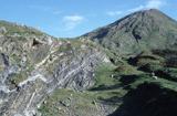 Connemara National ParkNational park · 3.8 mi
Explorer Tom I came to Connemara National Park ready to admire the mountains and got distracted by plants that eat their dinner. Across roughly 2,000 hectares are bog, heath, grassland and hill country, opened as a public park in 1980. Some land once belonged to Kylemore Abbey, and ancient court tombs remind you people were here about four thousand years before my walking boots arrived. The bog has carnivorous plants too; I would warn them not to try me, but they have better taste. Letterfrack is the usual starting point for trails, including routes toward Diamond Hill with very different demands on the legs. Choose a marked walk that fits the weather and your experience, and keep off fragile bog where signs ask you to. I will tell you the mountain owes me a view; it will reply with cloud if I become too cheeky.
More archaeology and monuments in County Galway · All of County Galway

What do you know about this place?Tap to add a comment or ask a question