
What is recorded here
From the National Monuments Service (Archaeological Survey of Ireland) record CW011-021
Places near here
Photo credits
- Maker not stated on source page, commons.wikimedia.org
- kevin higgins, Geograph · Creative Commons Attribution-ShareAlike 2.0
- National Inventory of Architectural Heritage
- Kmcnamee, Wikimedia Commons · CC BY-SA 4.0
- Maker not stated on source page, en.wikipedia.org
- Maker not stated on source page, www.flickr.com
- Queenbg77, Wikimedia Commons · CC BY-SA 4.0
- Sarah777, Wikimedia Commons · Public domain
- Maker not stated on source page, www.interment.net
- Maker not stated on source page, www.pinterest.com
 Earthwork in CoolnakishaEarthwork · 499 yd
Explorer Tom Coolnakisha is doing exactly what it wants when nobody’s looking, which is mostly pretending to be a very boring patch…
 Rathvinden LockLock · 1709 yd
Explorer Tom Rathvinden Lock refuses to fall down because it knows it has the best view of the M9 bridge overhead. It’s derelict…
 Rathvinden HouseHouse · 1717 yd
Explorer Tom Rathvinden House has a Doric porch that looks like it's about to lecture you on proper posture and history. Toast it…
 Superbowl, Michael DavittGAA ground · 1.0 mi
 Earthwork in JohnduffswoodEarthwork · 1.1 mi
Explorer Tom Earthwork in Johnduffswood is a lozenge-shaped raised area that has now been swallowed by woodland. Saint Patrick would…
 Leighlinbridge CemeteryCemetery · 1.2 mi
Explorer Tom Leighlinbridge Cemetery would order a chip buty with mush if it could go to the shop. It thinks everything is better…
 Saint Laserian's Catholic ChurchChurch/chapel · 1.2 mi
Explorer Tom Saint Laserian's Catholic Church in Ballyknockan has a belfry that looks like it was built by someone who really liked…
 store/warehouse1.2 mi
Explorer Tom Store or warehouse in Ballyknockan (two) is surviving on retail fumes and stubbornness. It would cope terribly on a…
 Leighlin BridgeBridge · 1.3 mi
Explorer Tom Leighlin Bridge has eight arches and thinks it’s a diva because it incorporates fabric from an earlier bridge. It was…
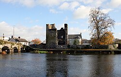 Black Castle (in ruins)Castle, tower house · 1.3 mi
Explorer Tom Black Castle was built to defend the bridge in 1320, so it’s seen some proper traffic over the years. I bet it smells…
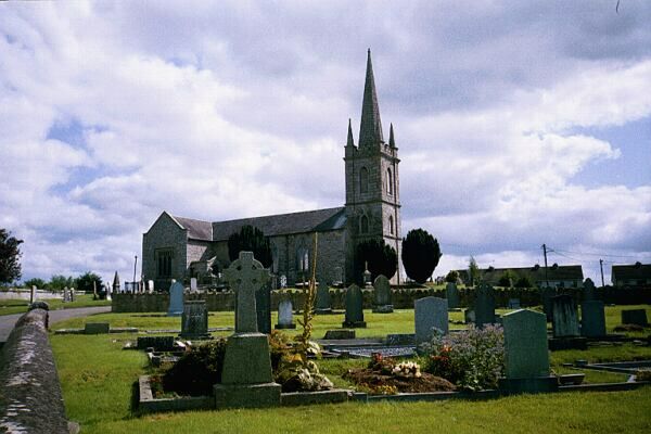 Flat cemetery in LeighlinbridgeFlat cemetery · 1.4 mi
Explorer Tom Flat cemetery in Leighlinbridge thinks modern buildings are tacky and has strong opinions about urns. It’s been sitting…
 CastleCastle, unclassified · 1.5 mi
Explorer Tom Castle in Ballynaboley is marked on an old map but nobody knows where it actually is. Saint Patrick would have said…
More archaeology and monuments in County Carlow · All of County Carlow

What do you know about this place?Tap to add a comment or ask a question