
What is recorded here
Situated at the foot of a high W-facing cliff near Lackwee. An old field wall, part of an extensive field system (MA084-001001-) terminates at the foot of the cliff 11m to NE. A spring rises 3m to N from which a small stream issues. It consists of a spread of loose stones filling and defining a roughly rectangular…
Read the whole record
From the National Monuments Service (Archaeological Survey of Ireland) record MA084-018
Places near here
Photo credits
- National Inventory of Architectural Heritage
- Colin Park, Geograph · CC BY-SA 2.0
- Ire2500, Wikimedia Commons · Public domain
- Colin Park, Wikimedia Commons · CC BY-SA 2.0
- Graham Horn, Geograph · CC BY-SA 2.0
- Andreas F. Borchert, Wikimedia Commons · CC BY-SA 4.0
- Maker not stated on source page, www.flickr.com
- Keith Salvesen, Geograph · CC BY-SA 2.0
- Markbriggs, Wikimedia Commons · CC BY-SA 3.0
- Maker not stated on source page, www.absoluteescapes.com
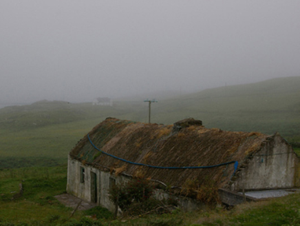 farm house1050 yd
Explorer Tom Farm house in Strake on Clare Island has a poet who fell in the ditch nearby as its main attraction. The thatch looks…
 Shivel Head Signal TowerSignal tower · 1139 yd
Explorer Tom Shivel Head Signal Tower on Clare Island is another one of these silent sentinels from the early 1800s. It’s just…
 Clare Island Signal TowerRuins · 1141 yd
Explorer Tom Clare Island Signal Tower would spend its lotto win on buying a loud megaphone to announce its existence to passing…
 KnockmoreMountain / peak · 1.5 mi
Explorer Tom Knockmore rises above Clare Island overlooking Clew Bay. This is the island's 462 metre high point, not the County Mayo…
 Clare IslandIsland · 2.1 mi
Explorer Tom I had barely stepped off the boat when Clare Island began testing my history lessons. Clare Island guards Clew Bay with…
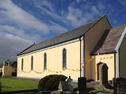 Catholic Church of the Sacred HeartChurch/chapel · 2.1 mi
Explorer Tom Catholic Church of the Sacred Heart on Clare Island hears everything through its thick walls, including your internal…
 ScalpatruceMountain / peak · 2.2 mi
Explorer Tom Scalpatruce has a name that sounds like someone gargled gravel and then called it a day, which is probably why locals…
 AbbeyReligious house, Cistercian monks · 2.2 mi
Explorer Tom Abbey in Strake is a Cistercian relic on Clare Island that seems to have an unlikely celebrity friend who visits just…
 Stone CrossCross-inscribed pillar · 2.2 mi
Explorer Tom Stone Cross at Strake got dragged into a school wall back in the eighties, probably for free heating. In a job…
 The StrandBeach / strand · 18 mi
Explorer Tom The Strand is known to rearrange its own pebbles when nobody’s looking, just to see if anyone notices the subtle…
 Omey IslandIsland · 19 mi
Explorer Tom Omey likes to disappear behind Connemara's sand until the tide decides whether you may visit. The route from…
 Doon Castle (in ruins)Castle, unclassified · 19 mi
Explorer Tom Doon Castle sits on a rock outcrop that looks like it’s trying to hide from the bay, probably embarrassed by its own…
More archaeology and monuments in County Mayo · All of County Mayo

What do you know about this place?Tap to add a comment or ask a question