Places near here
Photo credits
- Maker not stated on source page, www.pinterest.com
- Maker not stated on source page, www.pinterest.ru
- IrishFireside, Wikimedia Commons · CC BY-SA 2.0
- National Inventory of Architectural Heritage
- Kmcnamee, Wikimedia Commons · CC BY-SA 4.0
- Michael Murtagh, Geograph · CC BY-SA 2.0
- Dieglop, Wikimedia Commons · CC BY-SA 4.0
- Oliver Dixon, Geograph · CC BY-SA 2.0
- Maker not stated on source page, www.travelandleisureasia.com
- Malene Thyssen, Wikimedia Commons · CC BY-SA 3.0
 Fairy fort / stone ringfort in BarnarobinFairy fort / stone ringfort · 430 yd
Explorer Tom Fairy fort in Barnarobin had a prophecy that said it would float away on the next high tide, but we’re all still here.…
 Church (in Ruins)Graveyard · 1698 yd
Explorer Tom Church in Keelty refuses to fall down because it thinks gravity is just a suggestion and it hasn't agreed to the terms…
 BenbulbinMountain / peak · 1701 yd
Explorer Tom I came to Sligo expecting poetry; the mountain brought a geology lesson. Benbulbin looks like somebody levelled the top…
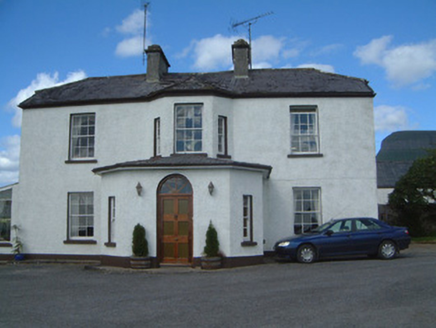 Urlar HouseHouse · 1721 yd
Explorer Tom Urlar House has had so many names it’s started calling itself whatever it feels like that week, which is very annoying…
 Oxfield, Drumcliffe/Rosses PointGAA ground · 1.6 mi
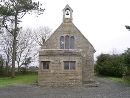 Saint Kevin's Church (Drumcliff)Church/chapel · 1.7 mi
Explorer Tom Saint Kevin’s Church in Drumcliff is tiny but packed with Tudor revival charm, including a corner window that looks…
 Kings MountainMountain / peak · 1.8 mi
Explorer Tom Kings Mountain in County Sligo was saved by a hero so obscure even his own ghost forgets his name. It stands tall over…
Monsignor Hynes Park, St. Molaise GaelsGAA ground · 2.7 mi Glencar WaterfallVisitor information · 5.3 mi
Explorer Tom Glencar Waterfall in County Leitrim gave up sugar for Lent but ended up eating a whole wheel of cheese instead anyway.…
 Glencar IslandIslet · 5.3 mi
Explorer Tom Glencar Island in County Leitrim would complain to the council about the noise levels from the swans, claiming they’re…
 CastleCastle, unclassified · 19 mi
Explorer Tom Castle at Killybegs was probably a McSwyne stronghold. A 1622 record described a ruinous castle beside a stone bawn; an…
 European Beech19 mi
Explorer Tom European Beech in County Donegal is a tree that pretends to be from somewhere warmer but lives here anyway. Vikings…
More archaeology and monuments in County Sligo · All of County Sligo

What do you know about this place?Tap to add a comment or ask a question