
What is recorded here
Attached single-bay three-storey former store or warehouse associated with former corn mill, built c. 1860. Now out of use\in use as outbuilding. Pitched corrugated roof, now collapsing, having projecting stone eaves course. Rubble stone walls. Pulley mechanism over opening at second floor level. Central square-headed…
Read the whole record
From the Buildings of Ireland (National Inventory of Architectural Heritage) record 40818035
Places near here
Photo credits
- National Inventory of Architectural Heritage
- Kenneth Allen, Geograph · CC BY-SA 2.0
- P L Chadwick, Geograph · CC BY-SA 2.0
- John M, Geograph · Creative Commons Attribution-ShareAlike 2.0
- Maker not stated on source page, en.wikipedia.org
- Proinsias Carr / Donegal GAA, donegalgaa.ie
- Maker not stated on source page, www.dreamstime.com
- Maker not stated on source page, www.pinterest.com
- Maker not stated on source page, commons.wikimedia.org
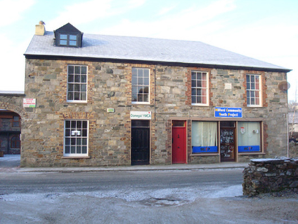 Donegal YMCA\Milford Community Youth ProjectHouse · 50 yd
Explorer Tom Donegal YMCA in Fogher used to be two sweet houses but now one has a shopfront slapped on it like a bad sticker. A…
 St. Peter's Catholic ChurchChurch/chapel · 55 yd
Explorer Tom St. Peter's Catholic Church has a rooster on top that probably thinks it is in charge of the whole town. I bet every…
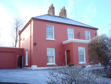 Lake ViewHouse · 67 yd
Explorer Tom Lake View was built around 1860 and might have been a surgery, which means someone probably had a very bad day waiting…
 The Travellers InnHouse · 142 yd
Explorer Tom The Travellers Inn has a rounded corner made to spare it from passing traffic. Dated 1867, it may be Milford's earliest…
 The Traveller's InnRestaurant · 143 yd
Explorer Tom The Traveller's Inn at Kilmacrennan Road junction might be hiding a map in the sauce. I bet the chef knows where the…
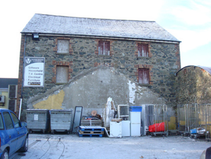 Milford Drapery and InteriorsStore/warehouse · 168 yd
Explorer Tom Milford Drapery and Interiors was built by someone who really wanted to sell fabric but ended up selling bricks…
 Milford Reformed Presbyterian ChurchChurch/chapel · 177 yd
Explorer Tom Milford Reformed Presbyterian Church has a curse that only hits people who don't wave at it first, so make sure you're…
 Mapped cemeteryCemetery · 280 yd
Explorer Tom Mapped cemetery handles nosy neighbours by pretending not to hear them, which is an ancient skill that takes decades of…
 Moyle View Park, Milford GAAGAA ground · 547 yd
 Mapped graveyardGraveyard · 772 yd
Explorer Tom This unnamed graveyard in County Donegal had a massive falling out with the next village over who stole their windmill…
 Megalithic tomb in MillfordMegalithic tomb · 913 yd
Explorer Tom Megalithic tomb in Millford is basically a giant's grave that forgot to show up. Lewis swore he saw it back in eighteen…
 Standing stone in MillfordStanding stone · 927 yd
Explorer Tom Standing stone in Millford is a proper chunky guy, measuring .75m high × 1.5m wide at base. It looks like it’s been…
More historic places in County Donegal · All of County Donegal

What do you know about this place?Tap to add a comment or ask a question