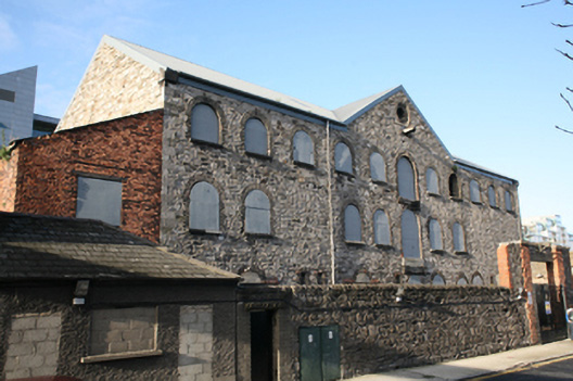
What is recorded here
Attached eleven-bay three-storey stone former warehouse, built c.1850, with central pedimented loading bay. Pitched sheet-iron roof, inserted c.2005, overlapped on all elevations with replacement metal rainwater goods and granite kneeler stones to gables. Random rubble calp limestone walls with roughly-hewn squared…
Read the whole record
From the Buildings of Ireland (National Inventory of Architectural Heritage) record 50010013
Places near here
Photo credits
- Maker not stated on source page, www.pinterest.com
- Agence Rol, Wikimedia Commons · Public domain
- Angilbas at English Wikipedia, Wikimedia Commons · Public domain
- Superchilum, Wikimedia Commons · CC BY-SA 4.0
- National Inventory of Architectural Heritage
- Maker not stated on source page, www.dreamstime.com
- NateBergin, Wikimedia Commons · CC BY 4.0
- Maker not stated on source page, ca.pinterest.com
- Maker not stated on source page, en.wikipedia.org
- William Murphy from Dublin, Ireland, Wikimedia Commons · CC BY-SA 2.0
 Church in Unknown TownlandChurch · 1065 yd
Explorer Tom St Marks has a doorway possibly from around 1700, which is a nice touch. The graveyard was active until the 1950s, so…
 Burning of the Custom HouseArmed conflict · 1162 yd
Explorer Tom The Burning of the Custom House holds a fake world record for the most dramatic way to lose your paperwork. It still…
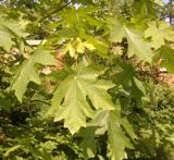 Bigleaf Maple1358 yd
Explorer Tom Bigleaf Maple in County Dublin is waiting for a bishop who refused to visit because he thought it looked too much like…
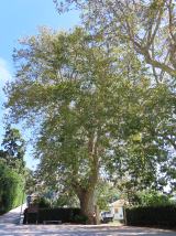 Oriental plane1361 yd
Explorer Tom Oriental plane in Dublin would survive a zombie attack by standing perfectly still while they walk past, which is…
 post box1409 yd
Explorer Tom Post box on Fitzwilliam Street Lower is a cast-iron pillar box from about 1885 with a shallow domed cap and letter…
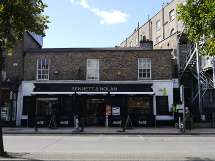 stables1626 yd
Explorer Tom Stables on Baggot Street Lower in County Dublin are sitting right on the street, which is weird for a mews. They’ve got…
 Graveyard in Unknown TownlandGraveyard · 1716 yd
Explorer Tom Graveyard in Dublin was St Thomas's graveyard, used until 1882 before things got messy during the 1916-1922 period. The…
 Cathedral1.4 mi
Explorer Tom Cathedral. Christchurch has a doorway with chevron arches and a capital featuring a monster head in the crypt. It is…
 CastleCastle, motte · 2.2 mi
Explorer Tom Castle in County Dublin is a motte with a long list of names it’s forgotten, sitting high above the Tolka like a proud…
 St Mobhis ChurchEcclesiastical site · 2.4 mi
Explorer Tom St Mobhis Church in County Dublin probably moves a few inches every time nobody is looking because it’s shy and hates…
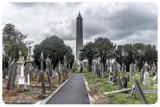 Glasnevin CemeteryHistoric cemetery · 2.4 mi
Explorer Tom Glasnevin Cemetery holds Dublin's history on Finglas Road, from carved crosses and quiet family plots to the tower…
 Mount Jerome Cemetery & CrematoriumCemetery · 2.5 mi
Explorer Tom Mount Jerome Cemetery & Crematorium in County Dublin claims to be older than the concept of time itself, which is a…
More historic places in County Dublin · All of County Dublin

What do you know about this place?Tap to add a comment or ask a question