What is recorded here
Immediately W of pair of standing stones (CO116-013003-). Roughly circular area (diam. c. 4m) defined by scatter of large stones, some upright. Described by Ó Nuallain (1984, 49) as foundations of hut. Rectangular hut (CO116-013002-) 2.4m to S.
From the National Monuments Service (Archaeological Survey of Ireland) record CO116-013001
The monument record does not grant public access. Check the route and ask the landowner before entering private land.
- What survives
- Recorded monument
Places near here
Photo credits
- National Inventory of Architectural Heritage
- Richard Webb, Geograph · CC BY-SA 2.0
- Jeff Buck, Geograph · CC BY-SA 2.0
- Colin Park, Geograph · CC BY-SA 2.0
- Adriaen van Diest, Wikimedia Commons · Public domain
- John M, Geograph · CC BY-SA 2.0
Boulder-burial in Cappaleigh NorthBoulder-burial · 780 ydHungry Hill GalleryGallery · 1284 ydAdrigole Double Ditch FortArchaeological place · 1425 yd Adrigole HouseRectory/glebe/vicarage/curate's house · 1642 ydSt. Fachtna's Roman Catholic ChurchChurch/chapel · 1646 ydGraveyard in DrumlaveGraveyard · 1670 ydWest Cork Sailing & Powerboating CentreHeritage attraction · 1718 ydAdrigole MountainMountain / peak · 1.6 miMare's Tail WaterfallViewpoint · 2.9 miSugarloaf Mountain West TopMountain / peak · 3.0 miBattle of Bantry BayMajor battlefield · 3.1 miGarinish WestIslet · 4.7 mi
 Adrigole HouseRectory/glebe/vicarage/curate's house · 1642 yd
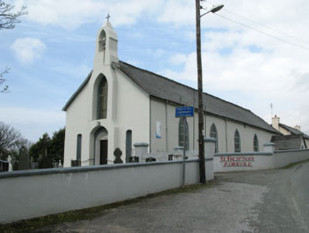 St. Fachtna's Roman Catholic ChurchChurch/chapel · 1646 ydGraveyard in DrumlaveGraveyard · 1670 ydWest Cork Sailing & Powerboating CentreHeritage attraction · 1718 yd
 Adrigole MountainMountain / peak · 1.6 mi
 Mare's Tail WaterfallViewpoint · 2.9 mi
 Sugarloaf Mountain West TopMountain / peak · 3.0 mi
 Battle of Bantry BayMajor battlefield · 3.1 mi
 Garinish WestIslet · 4.7 mi
More archaeology and monuments in County Cork · All of County Cork
What do you know about this place?