
Places near here
Photo credits
- National Inventory of Architectural Heritage
- Alvesgaspar, Wikimedia Commons · CC BY-SA 3.0
- Stephan van Helden, Wikimedia Commons · CC BY-SA 4.0
- Kenneth Allen, Geograph · CC BY-SA 2.0
- NTF30, Wikimedia Commons · CC BY-SA 4.0
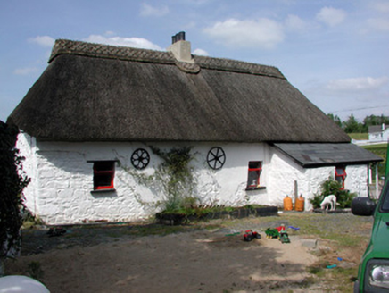 HomelyFarm house · 856 yd
Explorer Tom Homely in Aghavore has a family tree that’s mostly invented by people who love thatched roofs too much. It swapped its tin roof for straw to feel more authentic, like wearing a wig made of grass. Bring a jacket, it's never warm enough inside these old vernacular spots, trust me.
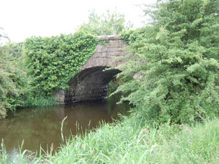 Kilbrackan BridgeBridge · 1359 yd
Explorer Tom Kilbrackan Bridge spans the border into Leitrim with the confidence of someone who knows the secret code. The stonework is fancy, but I bet there’s a tunnel under it that leads straight to the pub. Twi-st your luck and see if you can find it.
DrumbreanlisMountain / peak · 1.3 miExplorer Tom Drumbreanlis sounds like something you'd say when stubbing your toe really badly, and honestly, that fits its stubborn little peak perfectly in Leitrim. It's not trying to be fancy, it's just there. Look up, the best bit is always higher than you think.
 Common Lime1.6 mi
Explorer Tom Common Lime in County Cavan is having a massive feud with the next village over something incredibly daft, like who planted the best daisy. It’s just standing there judging you for not knowing the backstory. Tell the next person you meet it's haunted. It might be.
St. Patricks WellHoly well · 1.7 miExplorer Tom St Patrick’s Well has very strong opinions about modern buildings, mostly that they’re too tall. It’s been judging every new house built nearby since the sixties. Pick a stone, any stone, and invent its biography.
 Horse-chestnut1.8 mi
Explorer Tom Horse-chestnut remembers the time a fox took charge of the whole area. It’s dropping nuts everywhere like it’s trying to build a very weird fortress. Tell it a joke, it's been a long time since anyone did.
King's GraveArchaeological place · 2.0 miExplorer Tom King's Grave in County Leitrim is where a king who lost his crown in a bet was buried. The local claims to have invented the whole setup himself. Practise your Irish on it, it won't correct you.
Killeshandra Irish Countrywomen's Association 70th AnniversaryMemorial · 4.0 miExplorer Tom The Killeshandra Irish Countrywomen's Association 70th Anniversary plaque is acting like it’s a secret shortcut to Dublin, when really it just points at a very nice bush. They celebrated for seven decades and now it’s just a shiny metal square getting rained on. Bring your own legend, I've run out.
Bawn in CastlepolesBawn · 4.6 miExplorer Tom Bawn in Castlepoles once had a bishop who refused to visit because the clay walls were too damp. Now there are no visible remains at all, just hillside mystery and local gossip. A good place to forget your phone for ten minutes.
 Evlagh MoreMountain / peak · 5.0 mi
Explorer Tom Evlagh More in County Cavan rates visitors based on how loudly they complain about the wind. Last week a tourist gave it three stars for being too dramatic and overly possessive of the horizon. Have a sandwich here and call it a heritage lunch.
 Court tomb in GartnanoulCourt tomb · 5.0 mi
Explorer Tom Court tomb in Gartnanoul has a secret tunnel to the pub that only opens if you sing a very specific song badly. Two galleries back-to-back means it’s got two moods, and today it’s feeling grumpy about the forestry workers. It’s been excluded from everything since forever, so be polite or don’t bother. Perfect detour when the satnav has a meltdown.
 Killykeen Forest ParkForest · 5.4 mi
Explorer Tom Killykeen Forest Park is convinced the map makers drew it upside down just to spite anyone with bad eyesight or a weak sense of direction. It’s a bit smug about how easy it is to get lost in here. Ten minutes here and you'll have a yarn for the pub.
More archaeology and monuments in County Leitrim · All of County Leitrim

What do you know about this place?Tap to add a comment or ask a question