
Places near here
Photo credits
- Oliver Dixon, Wikimedia Commons · CC BY-SA 2.0
- Richard Webb, Wikimedia Commons · CC BY-SA 2.0
- Andrew Riley, Wikimedia Commons · CC BY-SA 2.0
- Alpin Stewart, Wikimedia Commons · CC BY-SA 2.0
- Lis Burke, Wikimedia Commons · CC BY-SA 2.0
- Adam Ward, Wikimedia Commons · CC BY-SA 2.0
- Claire Pegrum, Wikimedia Commons · CC BY-SA 2.0
- Mike Pennington, Wikimedia Commons · CC BY-SA 2.0
- Beth Loft, Wikimedia Commons · CC BY-SA 2.0
 Sanday, Ouse PointBuilding, Structure · 841 yd
 Sty WickBay · 848 yd
 Quoyness Chambered CairnArchaeological place · 1267 yd
Explorer Tom Quoyness makes you crawl into the past, quite literally. A nine-metre entrance passage runs through this Neolithic…
 Sanday, QuoynessChambered Cairn (neolithic), Cist (late Neolithic), Inhumation(s) (late Neolithic), Disc (slate)(late Neolithic), Knife (flint)(late Neolithic), Unidentified Pottery (pottery)(neolithic) · 1268 yd
 Leaving Quoyness CairnAncient tomb or cairn · 1380 yd
 Kettletoft BayBay · 1490 yd
 Sanday, ConningholeEnclosure, Kelp Pit(s) (post Medieval), Kelp Working Site (post Medieval) · 1633 yd
 Sanday, Geramount HouseCountry House (19th Century) · 1689 yd
 Sanday, GeramountCursus (neolithic) (possible), Enclosure, Treb Dyke(s) (bronze Age) (possible) · 1689 yd
 Sanday, Els NessCairn (possible), Site (possible) · 1.0 mi
 Sanday, Kettletoft BayNatural Feature (possible), Structure (possible) · 1.1 mi
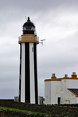 SandayIsland · 1.2 mi
More archaeology and monuments in Orkney Islands · All of Orkney Islands

What do you know about this place?Tap to add a comment or ask a question