
Places near here
Photo credits
- Nick Liddle, Wikimedia Commons · CC BY-SA 2.0
- Richard Webb, Wikimedia Commons · CC BY-SA 2.0
- John Comloquoy, Wikimedia Commons · CC BY-SA 2.0
- Beth Loft, Wikimedia Commons · CC BY-SA 2.0
- Oliver Dixon, Wikimedia Commons · CC BY-SA 2.0
- Alpin Stewart, Wikimedia Commons · CC BY-SA 2.0
- Ian Balcombe, Wikimedia Commons · CC BY-SA 2.0
- Andrew Riley, Wikimedia Commons · CC BY-SA 2.0
 Sanday, Kettletoft PierPier · 566 yd
 Sanday, Kettletoft Pier Head, Harbour LightBeacon · 592 yd
 Fishing boat at Kettletoft PierHeritage place · 614 yd
 Sanday, Kettletoft BayNatural Feature (possible), Structure (possible) · 675 yd
 Sty WickBay · 1.2 mi
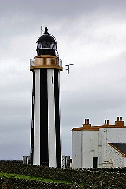 SandayIsland · 2.0 mi
 The CroftMuseum · 2.1 mi
 Sanday Heritage CentreMuseum · 2.1 mi
 Mid HolmIslet · 2.7 mi
 Cata Sand Dunes and BeachBeach · 2.8 mi
 Cata SandBeach / strand · 3.0 mi
 HowarNo Class (event) (21st Century) · 3.0 mi
More cliffs, bays and coast in Orkney Islands · All of Orkney Islands

What do you know about this place?Tap to add a comment or ask a question