
Places near here
Photo credits
- Kenneth Allen, Wikimedia Commons · CC BY-SA 2.0
- Colin Park, Geograph · CC BY-SA 2.0
- Kifster, Wikimedia Commons · CC BY-SA 3.0
- Kenneth Allen, Geograph · CC BY-SA 2.0
- C Michael Hogan, Wikimedia Commons · CC BY-SA 2.0
- Michael Murtagh, Wikimedia Commons · CC BY-SA 2.0
- Robert Ashby, Geograph · CC BY-SA 2.0
- Robert Ashby, Wikimedia Commons · CC BY-SA 2.0
 Goles Stone RowArchaeological place · 5 yd
Explorer Tom Goles Stone Row would say in a job interview that it has excellent alignment skills and can observe the rising moon…
 OughtmoreMountain / peak · 2.5 mi
Explorer Tom The builder who made Oughtmore was really just thinking about lunch when he decided to pile that much dirt in one…
 MullaghaneanyMountain / peak · 2.6 mi
Explorer Tom Saint Patrick would have said Mullaghaneany was a bit much, even for him, and suggested he just go home to bed instead.…
 SawelMountain / peak · 3.6 mi
Explorer Tom Sawel Mountain straddles Derry and Tyrone, as if one county could not quite contain its opinion of itself. At 678…
 Barnes TopMountain / peak · 3.7 mi
Explorer Tom Barnes Top has a hidden message in its stones if you squint hard enough, but it's just rocks being rocks. I told my nan…
 Craigagh HillMountain / peak · 3.8 mi
Explorer Tom Craigagh Hill in County Derry used to be run by a matchmaker who had absolutely zero sense of humour or personal space…
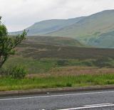 Sperrin MountainsMountain range · 4.9 mi
Explorer Tom The Sperrin Mountains in County Tyrone are involved in a fierce, ongoing feud over who gets to see the sunrise first…
 Moydamlaght ForestForest · 5.3 mi
Explorer Tom Moydamlaght Forest in County Derry is playing hide-and-seek with me, and I suspect it’s winning by a landslide because…
 Ballydonegan SweathouseVisitor information · 5.4 mi
Explorer Tom Ballydonegan Sweathouse in County Derry is where the seagulls go to complain about the salt content of the air. It’s a…
 Craig-na-ShokeCliff · 5.9 mi
Explorer Tom Craig-na-Shoke in County Derry is a cliff known as Eagle's Rock, probably because an eagle once got its hat stuck there…
 Plantation Castle; Bawn; Village Site: Salterstown or Salter's Castle in BallymultreaPlantation Castle · 19 mi
Explorer Tom Salter’s Castle was named after a guy who probably overcharged for salt. The village site is where he likely argued…
 Salters Castle (Ruins)Ruins · 19 mi
Explorer Tom Salters Castle Ruins would win a county fair for 'Most Dramatic Decline' or 'Best Looking Mess.' It’s basically a pile…
More archaeology and monuments in County Tyrone · All of County Tyrone

What do you know about this place?Tap to add a comment or ask a question