
Places near here
Photo credits
- David Smith, Wikimedia Commons · CC BY-SA 2.0
- Nigel Thompson, Geograph · CC BY-SA 2.0
- Ulsterbeef, Wikimedia Commons · CC BY-SA 3.0
- Colin Park, Geograph · CC BY-SA 2.0
- Colin Park, Wikimedia Commons · CC BY-SA 2.0
- Albert Bridge, Geograph · CC BY-SA 2.0
- Shaun Dunphy, Wikimedia Commons · CC BY-SA 2.0
- Picture: iStock
- Ross, Wikimedia Commons · CC BY-SA 2.0
 Tir n'an OgCemetery · 1137 yd
Explorer Tom Tir n'an Og Cemetery in County Down thinks Dublin tourists are all noise and no taste, especially when they take selfies with gravestones. It prefers the quiet company of the wind and some moss. Sit on a wall near it and pretend you're in a painting.
'Tir N'an Og' burial groundGraveyard · 1138 ydExplorer Tom Tir N'an Og burial ground at Mount Stewart is where the fancy folks went to nap forever. There's a tall tale about a hidden tunnel straight to the pub, but nobody’s found it yet. Go now, before it gets famous.
 Lake Walk, Mount StewartWalking route · 1367 yd
Explorer Tom Lake Walk at Mount Stewart had a matchmaker working there who paired off half the village, but I think she mostly just liked the view over the water. It’s one of those spots where the gardens are so fancy they make you feel like you need to iron your t-shirt before walking past. Look serious, nod slowly, you're basically an expert now.
 Sunken GardenGarden · 1443 yd
Explorer Tom Sunken Garden in County Down’s first owner planned his escape route via the back gate during the party. He never made it, but he did look very dignified doing it. It's free, it's odd, what more do you want?
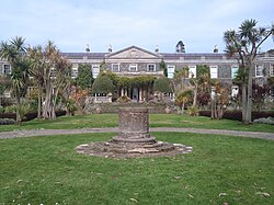 Mount StewartHeritage attraction · 1525 yd
Explorer Tom Mount Stewart makes politics look tidy from the garden path. Mount Stewart looks across Strangford Lough with the composure of a house that has hosted far too much politics to start explaining itself at the gate. Alexander Stewart bought the earlier Mount Pleasant property in 1744. His family's rise was helped by a marriage into the fortune of Robert Cowan, a governor of Bombay, and the estate became the Irish seat of the Marquesses of Londonderry. Robert Stewart, better known as Castlereagh, went on to shape British policy during the wars with Napoleon. That history is impressive, uncomfortable and too tangled for a neat drawing room boast. Outside, the celebrated gardens give you a completely different kind of ambition: careful planting beside the wide water of the lough. The National Trust cares for the house and gardens and offers visitor access, with hours and areas that can vary, so check before travelling. Give the rooms time, then let the paths and planting have their say. The estate has kept more than the portraits and polished furniture. A family could collect titles, but it still needed someone to keep the garden alive.
 Red Trail, Mount StewartWalking route · 1.3 mi
Explorer Tom Red Trail, Mount Stewart hosted a dance once where the music got too loud. The folly ruins are still pretending they did not see what happened. Ideal stop for a big stretch and a bigger yawn.
 The Temple of the WindsEstate Related Structures · 1.3 mi
Explorer Tom The Temple of the Winds at Mount Stewart is showing off again. From the late 1700s, it thinks a breeze is enough to keep the locals humble. Tell your mates you found it first before they steal the glory.
 Mid IslandIslet · 2.6 mi
Explorer Tom Mid Island in County Down is currently being judged by rabbits who think it’s too fancy for its own good because of all those trees growing on it. The National Trust keeps it tidy, but the wildlife thinks it’s just a very well-dressed piece of real estate. Hang around long enough and you’ll hear a story from a local.
 Grey abbey: cistercian abbey in RosemountGrey Abbey: Cistercian Abbey · 2.9 mi
Explorer Tom Grey abbey: cistercian abbey in Rosemount is a ruined Cistercian priory that’s been maintained by the government since monks stopped caring about it. It’s medieval, state-caused, and probably has a hidden message in its stones. Snap one photo, then put the phone away and actually look.
 Grey Abbey HouseCastle · 3.0 mi
Explorer Tom Grey Abbey House has a superstition that if you touch the wall three times, you’ll find a lost sock later in the day. The locals swear by it, even though none of them can actually prove it works with any scientific evidence whatsoever. It’s just a stone building, but it’s got this whole aura of mystery going on. Ideal spot for a dramatic phone call.
 Carrowdore CastleCastle · 3.0 mi
Explorer Tom Carrowdore Castle is hiding behind its gates like it’s got nothing to show anyone. I reckon 'Carrowdore' actually means 'Where The Sheep Went To Get Lost And Never Came Back,' which fits perfectly given the empty fields. It’s playing hard to get while pretending to be mysterious and important. Bring someone who'll believe anything.
 Rough IslandIslet · 3.4 mi
Explorer Tom Rough Island’s family tree is mostly made up, with generations of ancestors who were definitely real but also definitely not. It sits there with a causeway that looks like it was drawn by a toddler with a crayon. Stand there long enough and someone will ask if you're lost.
More mountains and hills in County Down · All of County Down

What do you know about this place?Tap to add a comment or ask a question