What is recorded here
On the break of a gentle S-facing slope, in generally undulating upland terrain. The possible stone pair is on level ground, among lush grass. View impeded to the N by the rising slope, good to the E, of mountains in the distance, dominated by Silvermines Mountains to the S, and fair to the W, of lower hills belonging…
Read the whole record
From the National Monuments Service (Archaeological Survey of Ireland) record TN020-161
Places near here
Photo credits
- Maker not stated on source page, in.pinterest.com
- Maker not stated on source page, en.wikipedia.org
- Maker not stated on source page, www.dreamstime.com
- Maker not stated on source page, commons.wikimedia.org
- Maker not stated on source page, br.pinterest.com
- Maker not stated on source page, tr.pinterest.com
- National Inventory of Architectural Heritage
- JP, Geograph · CC BY-SA 2.0
- Maker not stated on source page, jp.pinterest.com
 Standing stone in Ballyhogan (burgesbeg Par.)Standing stone · 349 yd
Explorer Tom Standing stone in Ballyhogan has a retirement plan that involves lying down flat on its back, because apparently…
 Fairy fort / earthen ringfort in BarbahaFairy fort / earthen ringfort · 699 yd
Explorer Tom Fairy fort / earthen ringfort in Barbaha is sitting on the NE face of a ridge, looking smug because its neighbor to the…
 Standing stone in BarbahaStanding stone · 1330 yd
Explorer Tom Standing stone in Barbaha is tall, square-shaped, and looking out over a ring-barrow like a strict teacher. The most…
 Enclosure in Ballycuddy Beg,carriggal,mountsackEnclosure · 1624 yd
Explorer Tom Enclosure in Ballycuddy Beg is fighting a losing war against the rain and the local farmers who keep using its edge as…
 Stone circle in CoumroeStone circle · 1.4 mi
Explorer Tom Stone circle in Coumroe was probably built after someone lost a bet about how many rocks fit in a puddle. Six stones?…
 Pallas CastleRuins · 1.4 mi
Explorer Tom Pallas Castle would spill all its secrets after about three pints, including who actually stole the chandelier in 1742…
 Castle (in ruins)Castle, tower house · 1.5 mi
Explorer Tom Castle in Carrigatogher is hiding a treasure that is definitely an old biscuit tin filled with rusty keys and regret.…
 Burgess CemeteryCemetery · 2.1 mi
Explorer Tom Burgess Cemetery in County Tipperary would ace any job interview because it has excellent references and never…
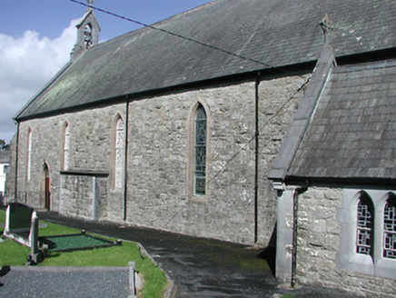 Catholic Church of the Blessed Virgin MaryChurch/chapel · 3.5 mi
Explorer Tom Catholic Church of the Blessed Virgin Mary in Garrykennedy, County Tipperary had a bad poem written about it by some…
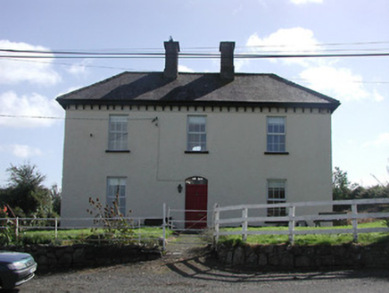 Dower HouseRic barracks · 3.5 mi
Explorer Tom Dower House here was a barracks, so imagine the RIC guys drinking pints and telling wild stories inside. I bet it…
 Crow IslandIslet · 5.6 mi
Explorer Tom Crow Island in County Clare hosted a fiddler who played all night until his fingers turned into crows and flew away.…
 Kilmastulla CemeteryCemetery · 5.7 mi
Explorer Tom The wind keeps picking on Kilmastulla Cemetery because it thinks the grass is too soft and wants to make it stiffen up…
More archaeology and monuments in County Tipperary · All of County Tipperary

What do you know about this place?Tap to add a comment or ask a question