
Places near here
Photo credits
- Kenneth Allen, Geograph · Creative Commons Attribution-ShareAlike 2.0
- National Inventory of Architectural Heritage
- Kenneth Allen, Wikimedia Commons · CC BY-SA 2.0
- Des Colhoun, Wikimedia Commons · CC BY-SA 2.0
- Castlefinn Community Project; individual photographer not named, castlefinn.ie
- Mat Fascione, Wikimedia Commons
- Kenneth Allen, Geograph · CC BY-SA 2.0
 St. Columba's Catholic ChurchChurch/chapel · 202 yd
Explorer Tom St. Columba's Catholic Church has these tiny Celtic crosses on the very top of its roof, just poking up there. It looks…
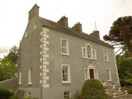 Magherycallaghan HouseCountry house · 363 yd
Explorer Tom Magherycallaghan House in Magherycallaghan is being claimed by a local as his own invention, which is bold for a house…
 Battlefield in Cloghfin (castlefin Ed)Battlefield · 1158 yd
Explorer Tom Battlefield in Cloghfin is actually run by a terrier named Buster who barks at anyone who steps too close to the old…
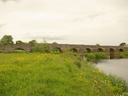 Clady BridgeBridge · 1204 yd
Explorer Tom Clady Bridge was built around 1680 and spans the River Finn right on the border between Donegal and Tyrone. It’s famous…
 Battle site: in 789 AD & battle of the fords , Southern crossing, 1689 in Clady; DonnygowanBattle site: in 789 AD & battle of the fords , Southern crossing, 1689 · 1230 yd
Explorer Tom Battle site: in 789 AD & battle of the fords, Southern crossing, 1689 in Clady has been waiting for a prophecy to come…
 Magherareagh Standing StoneStanding stone · 1702 yd
Explorer Tom Magherareagh Standing Stone is leaning so hard to the south-east it looks about to fall over! It’s two point one metres…
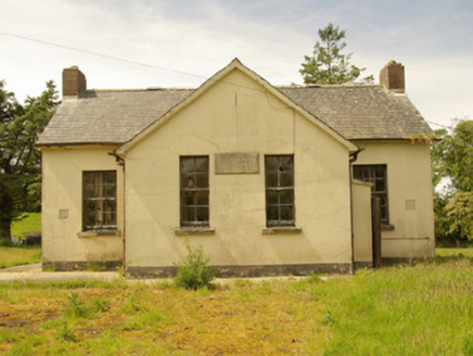 Alt National SchoolSchool · 1.2 mi
Explorer Tom Alt National School has its name and 1934 date cut into a stone plaque. A newer school opened nearby in 1960, but those…
 Páirc Eiméid, Robert Emmet's GAAGAA ground · 1.2 mi
 Cutt Park, St. Columba's GAA, UrneyGAA ground · 1.2 mi
 Gortfad HouseHouse · 1.5 mi
Explorer Tom Gortfad House has a bird living in its porch who refuses to leave, even though it’s clearly not his house. The…
 Urney Presbyterian ChurchChurch · 1.5 mi
Explorer Tom Urney Presbyterian Church has been listening to the same sermons since the seventeen-forties, which must be exhausting…
 McBride’s BarPub · 1.7 mi
Explorer Tom McBride’s Bar is looking south at Sandy Road, which sounds like a beach but feels like a trap set by gulls. I bet the…
More archaeology and monuments in County Donegal · All of County Donegal

What do you know about this place?Tap to add a comment or ask a question