
What is recorded here
Wedge shaped standing stone (H 1.3m x Wth 1.35m x T 0.8m) orientated on a NE-SW alignment, recorded during monitoring for a forestry development. It stands on the shoulder of raised ground overlooking low-lying boggy areas to the S and W including an historic lake or marshy area. It currently stands on the ground…
Read the whole record
From the National Monuments Service (Archaeological Survey of Ireland) record KE056-061
Places near here
Photo credits
- Maker not stated on source page, www.irelandhighlights.com
- Laune Rangers GAA Club official website; individual photographer not named, launerangers.ie
- Ian S, Geograph · CC BY-SA 2.0
- Maker not stated on source page, tr.pinterest.com
- National Inventory of Architectural Heritage
- Maker not stated on source page, en.wikipedia.org
- Pam Brophy, Wikimedia Commons · CC BY-SA 2.0
- User:Itub, Wikimedia Commons · CC BY-SA 3.0
- Golfing in Ireland; photographer not stated, Source publisher
 Fairy fort / earthen ringfort in KnocknaboolaFairy fort / earthen ringfort · 1336 yd
Explorer Tom Fairy fort / earthen ringfort in Knocknaboola is named Lissaghaunbeg, which sounds like a giant who got stuck in a…
 Standing stone in ArdmoneelStanding stone · 1.1 mi
Explorer Tom Standing stone in Ardmoneel is gone, probably because the map makers got their directions mixed up with a pub sign.…
 Laune Rangers GAA pitchGAA ground · 1.2 mi
 Saint Michael's Church (Killorglin)Church/chapel · 1.5 mi
Explorer Tom Saint Michael’s Church in Killorglin has been closed since ’97, but it’s definitely still judging you from the window.…
 Fairy fort / earthen ringfort in ArdmoneelFairy fort / earthen ringfort · 1.5 mi
Explorer Tom Fairy fort / earthen ringfort in Ardmoneel ended up in the wrong place because someone moved a house on top of it. It’s…
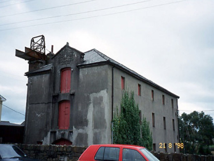 store/warehouse1.5 mi
Explorer Tom The store in Farrantoreen has an iron chute that looks like a shortcut but is actually just a very bad idea. It’s been…
 Cross-inscribed stone in ArdmoneelCross-inscribed stone · 1.5 mi
Explorer Tom Cross-inscribed stone in Ardmoneel has an imaginary fan club of marsh frogs who think the triple-armed cross is a…
 garage1.6 mi
Explorer Tom The Garage in Farrantoreen is all ball finials and pretense, pretending to be a mansion when it’s just a shed for cars.…
 Blennerhassett MonumentMonument · 1.6 mi
Explorer Tom Blennerhassett Monument has an unlikely celebrity friend who was actually just a very brave captain. He drowned in 1867…
 bridge1.6 mi
Explorer Tom Bridge in Castleconway over the Laune has eight arches and a plaque full of names. It’s basically a local celebrity who…
 King Puck statueMemorial · 1.6 mi
Explorer Tom King Puck statue in Killorglin, County Kerry has a ghost tenant who is too lazy to haunt it because he prefers watching…
 Maine Valley Golf ClubGolf course · 2.7 mi
More archaeology and monuments in County Kerry · All of County Kerry

What do you know about this place?Tap to add a comment or ask a question