What is recorded here
On the NE shore of Lough Gur at the current lake level, 305m SE of the summit of Knockfennell Hill. Located 50m SSW of Pollavaddra (a natural cave); 245m NE of a possible stone circle site ( LI032-014010-); 700m NE of a ringfort (LI032-014003-); 215m SE of Red Cellar Cave (LI032-281----) and 300m SE of a ring cairn (LI032-014009-). The standing stone is not depicted on the 1840 ed. OSi 6-inch map, and not depicted on the 1897 ed. OSi 25-inch map or on the Cassini ed. OSi 6-inch map. The standing stone is not distinguishable from the rocky shore of the lake on the OSi orthoimages taken 2005-12 nor on the Digital Globe orthoimages taken 2011-2013. O’Kelly (1944, 29) described the site as, 'a well weathered limestone slab 3ft 9 inches high (1.14m) and 2 ft 2 inches (0.66m) by 1ft 4 inches (0.4m) at the base. The socket in which it stands has been packed with small boulders. Grogan (1989, Vol. 2, 271) identified the site as ‘’Lough Gur 9’. The standing stone is not clearly visible on Google Earth orthoimages taken 05/04/2006; 28/06/2018 and 20/09/2020. See attached Google Earth orthoimages
Compiled by: Edmond O’Donovan
Date of upload: 6 November 2020
On the NE shore of Lough Gur at the current lake level, 305m SE of the summit of Knockfennell Hill. Located 50m SSW of Pollavaddra (a natural cave); 245m NE of a possible stone circle site ( LI032-014010-); 700m NE of a ringfort (LI032-014003-); 215m SE of Red Cellar Cave (LI032-281----) and 300m SE of a ring cairn (LI032-014009-). The standing stone is not depicted on the 1840 ed. OSi 6-inch map, and not…
From the National Monuments Service (Archaeological Survey of Ireland) record LI032-014011
The monument record does not grant public access. Check the route and ask the landowner before entering private land.
- What survives
- Recorded monument
Places near here
Photo credits
- Oliver Dixon, Geograph · CC BY-SA 2.0
- deiseal, Wikimedia Commons · CC BY-SA 2.0
- Martin Richard Phelan, Geograph · CC BY-SA 2.0
- National Inventory of Architectural Heritage
- Algirdas at Lithuanian Wikipedia, Wikimedia Commons · Public domain
- David Hawgood, Wikimedia Commons · CC BY-SA 2.0
- Ruhrfisch, Wikimedia Commons · CC BY-SA 4.0
- No machine-readable author provided. Christian1965~commonswiki assumed (based on copyright claims)., Wikimedia Commons · Public domain
- Dylan Moore, Geograph · CC BY-SA 2.0
 The SpectaclesVisitor information · 175 yd
 Bolin IslandCrannog · 227 yd
 Lough Gur Heritage CentreVisitor information · 256 yd
 kiln270 yd
 Pedunculate Oak399 yd
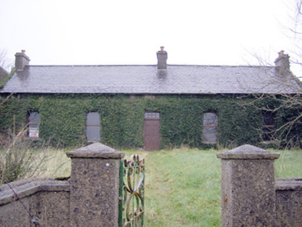 Lake ViewHouse · 413 ydGarret IslandCastle, unclassified · 949 ydBlack Castle (in ruins)Castle, tower house · 1039 yd
 Stone CirclesStone circle · 1645 yd
 Grange Stone CircleArchaeological place · 1747 yd
 Lough GurVisitor information · 1.0 mi
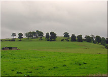 KnockainyMountain / peak · 3.7 mi
More archaeology and monuments in County Limerick · All of County Limerick
What do you know about this place?