What is recorded here
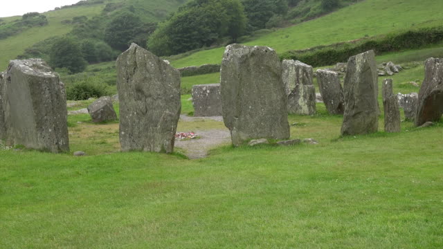
Knockmanagh holds four standing stones on R. Sheehan's land, though their exact positions have slipped from modern sight. They are not a polished monument or a named ceremonial chamber; they are a small cluster recorded by Bowman in 1934, likely marked by people who knew the field, not by visitors scanning a map. That absence is not a flaw. It is the shape of much of Ireland's old landscape: present in ownership, memory and local distinction, but no longer handed over as a display.
One of four standing stones (10075, 10076, 10078) recorded by Bowman (1934, 480) on R. Sheehan's land. Exact location not known.
The above description is derived from the published 'Archaeological Inventory of County Cork. Volume 4: North Cork' (Dublin: Stationery Office, 2000). In certain instances the entries have been revised and updated in the light of recent research.
Date of upload/revision: 14 January 2009
Likely dating to the Late Neolithic or Bronze Age, the standing stone may have been part of a ritual or funerary landscape. Its meaning or use is unclear, but such stones often marked territorial boundaries, served as memorials, or had ceremonial significance.
The monument record does not grant public access. Check the route and ask the landowner before entering private land.
- What survives
- Recorded monument
Places near here
 Standing StoneArchaeological place · 808 yd
 Man-made underground passage in GortearaghMan-made underground passage · 841 yd
 Wood ViewCountry house · 1.4 mi
 Castle McAuliffe (Site of)Castle, unclassified · 1.6 mi
 IndicatedHouse, vernacular house · 2.3 mi
 CastleCastle, unclassified · 2.8 mi
 Stanner's Glen, Priory WoodWood · 4.7 mi
 TaurMountain / peak · 4.9 mi
 Kanturk CastleHeritage attraction · 6.3 mi
 St Fursey's WellSpring · 8.2 mi
 Burial ground in AssolasBurial ground · 8.7 mi
 European YewEuropean Yew · 8.9 mi