
Places near here
Photo credits
- Andreas F. Borchert, Wikimedia Commons · CC BY-SA 4.0
- National Inventory of Architectural Heritage
- Willow, Wikimedia Commons · CC BY 2.5
- 瑞丽江的河水, Wikimedia Commons · CC BY-SA 4.0
- Colin Park, Geograph · CC BY-SA 2.0
- Jonathan Billinger, Wikimedia Commons · CC BY-SA 2.0
- Maker named on the Wikimedia Commons picture page · CC BY-SA 2.5
 Greatconnell Abbey (in ruins)Religious house, Augustinian canons · 1.5 mi
Explorer Tom Greatconnell Abbey is playing hard to get, claiming it’s just a field while its Augustinian ghosts do the hoovering. St…
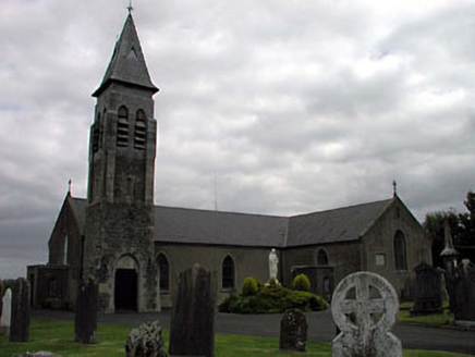 Saint Peter's Catholic ChurchChurch/chapel · 1.8 mi
Explorer Tom Saint Peter’s Church was built before Catholics could even breathe easy, which is some kind of heroism. Saint Patrick…
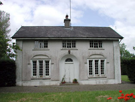 Dunnstown FarmHouse · 2.1 mi
Explorer Tom Dunnstown Farm has a hidden treasure that is definitely just a biscuit tin under the floorboards, I guarantee it. The…
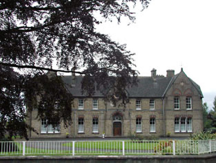 Holy Family ConventConvent/nunnery · 2.2 mi
Explorer Tom Holy Family Convent in Piercetown claims it took six million cups of tea to lay all that yellow brick. It’s maintaining…
 Elder3.7 mi
Explorer Tom An Elder tree almost got sold to a farmer for his horse, but he backed out when it refused to eat oats. It stands there…
 Rath Turtle MoatArchaeological place · 7.7 mi
Explorer Tom Rath Turtle Moat sits on a hilltop in Glen Ding Wood near Blessington, reached through a mix of deciduous and conifer…
 LobawnMountain / peak · 13 mi
Explorer Tom Lobawn in County Wicklow is playing hide-and-seek with me, hiding behind its own boring boundary stone which claims…
 SugarloafMountain / peak · 13 mi
Explorer Tom Tell someone you climbed Sugarloaf and they may picture the wrong Wicklow mountain entirely. This one stands west of…
 SlievereaghMountain / peak · 17 mi
Explorer Tom Slievereagh in County Wicklow has a long grudge against the weather because it keeps raining on its parade every single…
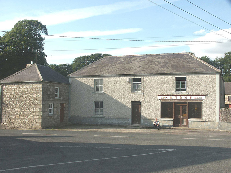 ByrneHouse · 19 mi
Explorer Tom Byrne in Rathdangan is stuck in a feud over who actually owns the view from that shopfront. It’s got some pebble-dash…
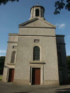 Saint Mary's Catholic ChurchChurch/chapel · 20 mi
Explorer Tom Saint Mary's Catholic Church in Killamoat Lower is dressed up in 1840s Classical style with Harry Clarke glass that…
 Sessile Oak20 mi
Explorer Tom Sessile Oak in County Wicklow holds the unofficial world record for looking the most bored while standing perfectly…
More archaeology and monuments in County Kildare · All of County Kildare

What do you know about this place?Tap to add a comment or ask a question