
What is recorded here
From the National Monuments Service (Archaeological Survey of Ireland) record DG088-004
Places near here
Photo credits
- Kenneth Allen, Geograph · CC BY-SA 2.0
- Kenneth Allen, Wikimedia Commons · CC BY-SA 2.0
- Maker not stated on source page, tr.pinterest.com
- National Inventory of Architectural Heritage
- Kenneth Allen, Geograph · Creative Commons Attribution-ShareAlike 2.0
- Maker not stated on source page, www.atlasobscura.com
- Maker not stated on source page, commons.wikimedia.org
- Maker not stated on source page, fi.pinterest.com
- Maker not stated on source page, en.wikipedia.org
- Maker not stated on source page, us.forums.blizzard.com
 Fearn HillMountain / peak · 1091 yd
Explorer Tom Fearn Hill sits in County Donegal with its access details completely unknown to the mapmakers. The only clue is a…
 Birdstown Standing StonePublicly named standing stone · 1444 yd
Explorer Tom Birdstown Standing Stone might be a very tall rock that birds use as a secret landing pad. I bet they land there to…
 Standing stone in SkelpyStanding stone · 1.0 mi
Explorer Tom Standing stone in Skelpy is no longer visible, having vanished from what used to be rocky marsh land. It was marked on…
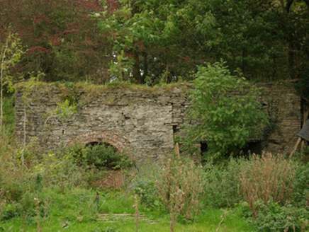 kiln1.6 mi
Explorer Tom Kiln in Alt Lower has a segmental-headed opening that was used to fire the stone. I bet you had to shout 'hot potato'…
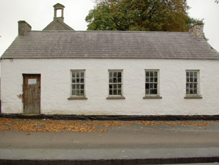 Alt National SchoolSchool · 1.6 mi
Explorer Tom Alt National School in Alt Lower would cope brilliantly on a reality show by just standing there and saying nothing.…
 Alt Presbyterian ChurchChurch/chapel · 1.6 mi
Explorer Tom Alt Presbyterian Church is showing off its elaborate classical entrance front with triglyphs, mutules, and a quirky…
 Standing stone in GortnamuckStanding stone · 2.4 mi
Explorer Tom Standing stone in Gortnamuck is still extant on level open ground, though it could only be inspected from a distance…
 Standing stone in DresnaghStanding stone · 2.8 mi
Explorer Tom Standing stone in Dresnagh would say to the place that replaced it: 'You’re doing fine, mate, but I’ve got better views…
 Standing stone in CoolyslinStanding stone · 2.8 mi
Explorer Tom Standing stone in Coolyslin is triangular, looking exactly like a giant 'Look This Way' sign pointing down at the Finn…
 Cist in LisnamulliganCist · 3.1 mi
Explorer Tom The cist at Lisnamulligan held the remains of an adult laid on their left side, with a complete bowl in one corner.…
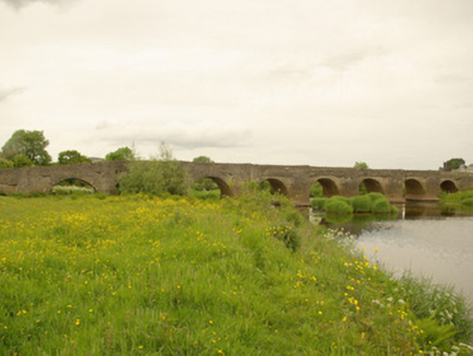 Clady BridgeBridge · 3.2 mi
Explorer Tom Clady Bridge was built around 1680 and spans the River Finn right on the border between Donegal and Tyrone. It’s famous…
 Fairy fort / ringfort in Tievebrack (cloghard Ed)Fairy fort / ringfort · 3.3 mi
Explorer Tom Fairy fort / ringfort in Tievebrack is basically just a rumor hiding in some pasture. There’s almost no trace left…
More archaeology and monuments in County Donegal · All of County Donegal

What do you know about this place?Tap to add a comment or ask a question