
What is recorded here
From the National Monuments Service (Archaeological Survey of Ireland) record CO039-150
Places near here
Photo credits
- Maker not stated on source page, www.virtualtourist.com
- Jonathan Thacker, Wikimedia Commons · CC BY-SA 2.0
- National Inventory of Architectural Heritage
- Maker not stated on source page, www.dreamstime.com
- Mike Searle, Wikimedia Commons · CC BY-SA 2.0
- Maker not stated on source page, www.wikidata.org
- Jonathan Thacker, Geograph · Creative Commons Attribution-ShareAlike 2.0
- Kmcnamee, Wikimedia Commons · CC BY-SA 4.0
- Maker not stated on source page, commons.wikimedia.org
- Jonathan Thacker, Geograph · CC BY-SA 2.0
 Church (Site of)Church · 1127 yd
Explorer Tom Church in Gortageen is marked by two whitethorn trees on the south side, according to local legend. No visible surface…
 Millstreet Railway StationRailway station · 1329 yd
Explorer Tom Millstreet Railway Station has been standing since 1853, mixing sandstone and limestone like a fancy chef. It’s got a…
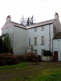 Flintfield HouseCountry house · 1694 yd
Explorer Tom Flintfield House dates back to seventeen-thirty-nine and is still standing. It's got diminishing windows that make it…
 Fairy fort / earthen ringfort in LiscreaghFairy fort / earthen ringfort · 1717 yd
Explorer Tom Fairy fort / earthen ringfort in Liscreagh is completely levelled now, no trace at all. But the maps show it was there!…
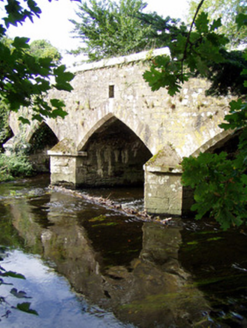 Wallis's BridgeBridge · 1749 yd
Explorer Tom Wallis's Bridge in Dooneens is strutting its pointed arches like it invented the concept of looking good over water.…
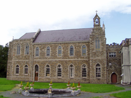 Drishane CastleChurch/chapel · 1.0 mi
Explorer Tom Drishane Castle is actually a chapel from 1910 built by the Sisters of the Infant Jesus. It’s now housing asylum…
 Castle and TurretCastle, tower house · 1.0 mi
Explorer Tom Castle and Turret in Drishane More was built by Mac Carthys in 1450, or so tradition claims. Now it's attached to an…
 Church (in Ruins)Church · 1.2 mi
Explorer Tom Church in Drishane More is playing hide-and-seek with me. The record says it’s just overgrown rubble and burials, but…
 Grave YardGraveyard · 1.2 mi
Explorer Tom Graveyard in Drishane More was part of a convent's grounds. Oldest stone dates to 1725. Nuns were buried on the east…
 St. John's GAA pitchGAA ground · 1.5 mi
 Duggan Park, MillstreetGAA ground · 1.8 mi
 St. Patrick's ChurchVisitor information · 1.9 mi
Explorer Tom St. Patrick's Church has an ongoing feud with the rain because it keeps getting wet and grumpy. The building looks like…
More archaeology and monuments in County Cork · All of County Cork

What do you know about this place?Tap to add a comment or ask a question