What is recorded here
From the National Monuments Service (Archaeological Survey of Ireland) record KE101-015002
Places near here
Photo credits
- Maker not stated on source page, www.pinterest.com
- Maker not stated on source page, www.irelandhighlights.com
- Maker not stated on source page, uk.pinterest.com
- Maker not stated on source page, de.wikipedia.org
- Maker not stated on source page, www.flickr.com
- Nigel Cox, Geograph · CC BY-SA 2.0
- John M, Geograph · CC BY-SA 2.0
- Keith Cunneen, Geograph · CC BY-SA 2.0
- National Inventory of Architectural Heritage
- Peter Craine, Wikimedia Commons · CC BY-SA 2.0
 Enclosure in DerrysallaghEnclosure · 401 yd
Explorer Tom Enclosure in Derrysallagh would cope on a reality show by sitting there doing absolutely nothing and winning for being…
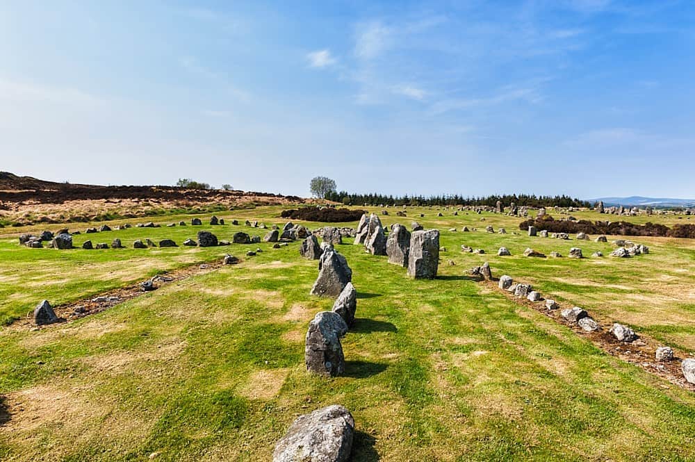 Stone row in DerrysallaghStone row · 495 yd
Explorer Tom Stone row in Derrysallagh looks like two stones having a quiet feud with the next village over something daft. One is…
 Standing stone in Dromroe (glanarought By.)Standing stone · 954 yd
Explorer Tom Standing stone in Dromroe would win a county fair for 'Most Boring but Important' without even trying. It sits inside a…
 Stone CircleStone circle, multiple-stone · 958 yd
Explorer Tom Stone Circle in Dromroe had a cow try to buy it last week because she thought it was a premium parking spot. Thirteen…
 Fairy fort / earthen ringfort in CarksFairy fort / earthen ringfort · 1396 yd
Explorer Tom This Carks fort watched the Vikings get lost looking for it, which must have been quite the comedy. It’s half-buried…
 Wedge tomb in MaulagownaWedge tomb · 1.6 mi
Explorer Tom Wedge tomb in Maulagowna would tell you it saw things after three pints that you wouldn’t believe. It’s got a sloping…
 Bridge in MaulagownaBridge · 1.9 mi
Explorer Tom Bridge in Maulagowna thinks the road leading to it is a total rip-off and probably charges tolls in pebbles. It’s just…
 Gleninchaquin WaterfallWaterfall · 2.2 mi
Explorer Tom Gleninchaquin Waterfall is one hundred and forty metres of pure, unfiltered attitude, absolutely refusing to be…
 Baurearagh MountainMountain / peak · 2.8 mi
Explorer Tom Baurearagh Mountain in County Kerry fooled the mapmakers into drawing it three kilometers away from where it actually…
 Killane Mountain South-West TopMountain / peak · 3.7 mi
Explorer Tom Killane Mountain South-West Top has very strong opinions on modern building codes and hates that nobody respects its…
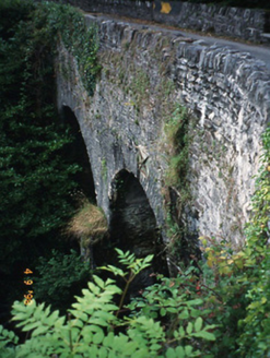 Blackwater BridgeBridge · 5.3 mi
Explorer Tom Blackwater Bridge would explain the 1800s to a teenager as just a really long queue for tea. The pedestrian refuge is…
 Glengarriff WoodsWood · 5.5 mi
Explorer Tom Glengarriff Woods has old oaks that survived a spell when people thought the answer to every forestry question was…
More archaeology and monuments in County Kerry · All of County Kerry

What do you know about this place?Tap to add a comment or ask a question