What is recorded here
Coleraine still keeps a standing stone from the prehistoric dark. Whether it marked a boundary, a burial or a warning, people once watched that stone instead of looking away.
The official Northern Ireland record identifies this as STANDING STONE. Recorded period: PREHISTORIC; UNCERTAIN. The official map point was placed at the centre of the recorded archaeological site from the source map reference.
Likely dating to the Neolithic or Bronze Age, this standing stone may have served a ceremonial, astronomical, or territorial function. No specific folklore or detailed local tradition is recorded for this site.
The monument record does not grant public access. Check the route and ask the landowner before entering private land.
- What survives
- Recorded monument
Places near here
 Terrace Row Presbyterian ChurchChurch · 894 yd
 Congregational ChurchChurch · 1063 yd
 THE CITADEL: 17th century Fortification in Coleraine AND SuburbsTHE CITADEL: 17th century Fortification · 1064 yd
 Millennium MilepostVisitor information · 1138 yd
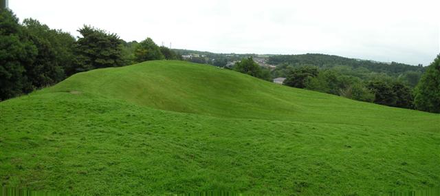 PREHISTORIC SETTLEMENT SITE, MOTTE, PROMONTORY FORT & ARTILLERY FORT: MOUNTSANDEL FORT in Mount SandelPREHISTORIC SETTLEMENT SITE, MOTTE, PROMONTORY FORT & ARTILLERY FORT: MOUNTSANDEL FORT · 1242 yd
 Somerset ForestForest · 1439 yd
 Castleroe WoodWood · 1.8 mi
 Quilley Picnic AreaPicnic place · 2.7 mi
 CASTLE & SETTLEMENT SITE (unlocated) in GlebeCASTLE & SETTLEMENT SITE (unlocated) · 3.2 mi
 Portstewart StrandBeach / strand · 4.3 mi
 CHURCH & GRAVEYARD: BALLYWILLIN in GlebeCHURCH & GRAVEYARD: BALLYWILLIN · 4.8 mi
 Hezlett HouseHeritage attraction · 4.9 mi