
What is recorded here
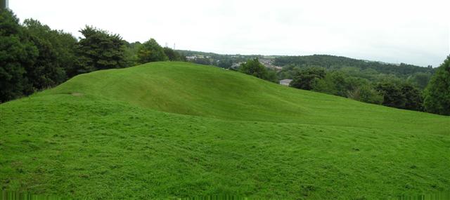
Mortared stone and compacted earth still mark the citadel built during the 17th century in Coleraine AND Suburbs. It was a fortified place, not a passing camp, and its lines would have cut across the ordinary life of the town. People may have worked, waited, feared or raged inside those walls while the wider region changed hands and habits.
The official Northern Ireland record identifies this as THE CITADEL: 17th century Fortification. Recorded period: C17TH. The official map point was placed at the centre of the recorded archaeological site from the source map reference.
The monument record does not grant public access. Check the route and ask the landowner before entering private land.
- What survives
- Recorded monument
Places near here
 Bann BridgeBridge · 132 yd
 Methodist ChurchChurch · 184 yd
 Millennium MilepostVisitor information · 192 yd
 EARLY MONASTIC SITE & POST-MED. CHURCH & GRAVEYARD: ST. PATRICK'S in ColeraineEARLY MONASTIC SITE & POST-MED. CHURCH & GRAVEYARD: ST. PATRICK'S · 366 yd
 PREHISTORIC SETTLEMENT SITE, MOTTE, PROMONTORY FORT & ARTILLERY FORT: MOUNTSANDEL FORT in Mount SandelPREHISTORIC SETTLEMENT SITE, MOTTE, PROMONTORY FORT & ARTILLERY FORT: MOUNTSANDEL FORT · 1.1 mi
 Somerset ForestForest · 1.4 mi
 Castleroe WoodWood · 2.1 mi
 Quilley Picnic AreaPicnic place · 2.7 mi
 CASTLE & SETTLEMENT SITE (unlocated) in GlebeCASTLE & SETTLEMENT SITE (unlocated) · 2.8 mi
 Portstewart StrandBeach / strand · 4.0 mi
 CHURCH & GRAVEYARD: BALLYWILLIN in GlebeCHURCH & GRAVEYARD: BALLYWILLIN · 4.2 mi
 Hezlett HouseHeritage attraction · 4.9 mi
Other information
Photo: Credit not shown in the picture search · Rights wording not checked; contact us if this picture should be removed