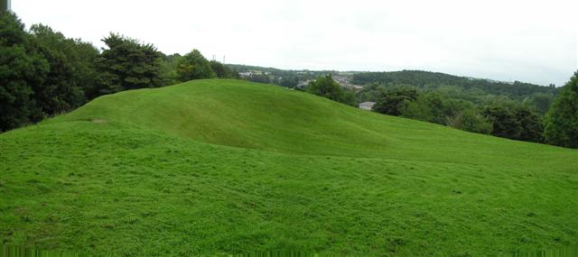
What is recorded here
Mount Sandel in County Derry is a rare place where a prehistoric settlement, a medieval motte and a later artillery fort all share the same ground. It is not a single moment frozen in stone but a long human argument about height, defence and belonging. Each layer buried or built upon the last, yet the hill still holds every hand that shaped it.
The official Northern Ireland record identifies this as PREHISTORIC SETTLEMENT SITE, MOTTE, PROMONTORY FORT & ARTILLERY FORT: MOUNTSANDEL FORT. Recorded period: PREHISTORIC; POST-MED; L.B.A./I.A.; NEOLITHIC; MESOLITHIC; MED/L.MED. Recorded protection: State Care. The official map point was placed at the centre of the recorded archaeological site from the source map reference.
Mount Sandel Fort is a multi-period site in Northern Ireland featuring a promontory fort and prehistoric settlement remains, with evidence dating back to the Mesolithic and Neolithic periods. While later medieval and post-medieval structures such as a motte and artillery fort are also present, the site is not traditionally associated with fairy folklore.
The monument record does not grant public access. Check the route and ask the landowner before entering private land.
- What survives
- Recorded monument
Places near here
 Mount Sandel FortArchaeological place · 4 yd
 Somerset ForestForest · 925 yd
 Terrace Row Presbyterian ChurchChurch · 1437 yd
 ENCLOSURE in KnockanternENCLOSURE · 1683 yd
 Congregational ChurchChurch · 1736 yd
 Castleroe WoodWood · 1.1 mi
 Millennium MilepostVisitor information · 1.2 mi
 Quilley Picnic AreaPicnic place · 3.4 mi
 CASTLE & SETTLEMENT SITE (unlocated) in GlebeCASTLE & SETTLEMENT SITE (unlocated) · 3.9 mi
 Portstewart StrandBeach / strand · 5.0 mi
 CHURCH & GRAVEYARD: BALLYWILLIN in GlebeCHURCH & GRAVEYARD: BALLYWILLIN · 5.1 mi
 FORTIFIED HOUSE in ProspectFORTIFIED HOUSE · 5.6 mi
Other information
Photo: Kenneth Allen · CC BY-SA 2.0