
What is recorded here
Recorded construction date: 1860 - 1879. Current recorded use: Church.
From the Northern Ireland Historic Buildings Record record HB03/18/014
The official record and map point do not grant access. Many historic buildings are privately owned; view them only from public ground unless the owner allows entry.
Places near here
Photo credits
- Kenneth Allen, Wikimedia Commons · CC BY-SA 2.0
- Kenneth Allen, Geograph · CC BY-SA 2.0
- Richard Webb, Geograph · CC BY-SA 2.0
- Albert Bridge, Geograph · CC BY-SA 2.0
- Shane Killen, Geograph · CC BY-SA 2.0
- Robert Ashby, Geograph · CC BY-SA 2.0
- D LN, Wikimedia Commons · CC BY-SA 4.0
 Bank of IrelandBank · 168 yd
 Early Monastic Site & Post-med. Church & Graveyard: St. Patrick's in ColeraineEarly Monastic Site & Post-med. Church & Graveyard: St. Patrick's · 264 yd
 St Patrick's ChurchChurch · 274 yd
 Millennium MilepostVisitor information · 469 yd
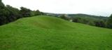 Prehistoric Settlement Site, Motte, Promontory Fort & Artillery Fort: Mountsandel Fort in Mount SandelPrehistoric Settlement Site, Motte, Promontory Fort & Artillery Fort: Mountsandel Fort · 1736 yd
 Somerset ForestForest · 1.3 mi
 Castleroe WoodWood · 1.9 mi
 Quilley Picnic AreaPicnic place · 2.8 mi
 Portstewart StrandBeach / strand · 4.1 mi
 Church & Graveyard: Ballywillin in GlebeChurch & Graveyard: Ballywillin · 4.2 mi
 West StrandBeach / strand · 5.0 mi
 Hezlett HouseHeritage attraction · 5.0 mi
More historic places in County Derry · All of County Derry
What do you know about this place?