
Places near here
Photo credits
- Andreas F. Borchert, Wikimedia Commons · CC BY-SA 4.0
- National Inventory of Architectural Heritage
- Kenneth Allen, Geograph · CC BY-SA 2.0
- Richard Webb / Geograph Ireland, www.geograph.ie
- MoorsoP, Wikimedia Commons · CC BY-SA 4.0
- Corinna Schleiffer, Wikimedia Commons · CC BY-SA 2.0
- Patrick Mackie, Geograph · CC BY-SA 2.0
- Rossographer, Geograph · CC BY-SA 2.0
 St. Mary's Catholic ChurchChurch/chapel · 225 yd
Explorer Tom St. Mary's Catholic Church in Ballybrack replaced an older chapel and has a tower that acts as a local landmark. The…
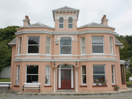 Glenburnie HouseHouse · 723 yd
Explorer Tom Glenburnie House was built for Mr. Bartholomew McCorkell, who apparently loved watching sailing ships slide past Lough…
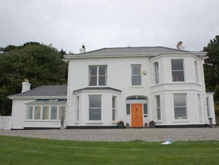 Drumaweir HouseHouse · 791 yd
Explorer Tom Drumaweir House in Drumaweir is the subject of a bad poem someone wrote about it, which mentions its sling sash windows…
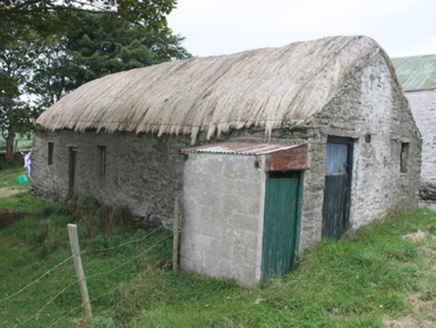 outbuilding859 yd
Explorer Tom Outbuilding in Ballybrack has a rough date stone that says 'Built 1948 J Kelly'. I bet J Kelly was very proud of his…
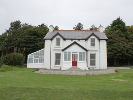 Portachappel HouseHouse · 1000 yd
Explorer Tom House in Mountcharles has retained its timber sash windows and early timber panelled door despite some renovations.…
 St. Finian Church of Ireland ChurchChurch/chapel · 1193 yd
Explorer Tom St. Finian Church of Ireland Church has louvers on its tower that look like they’re breathing! Built c. 1782, I bet…
 Carrick Field, Moville GAAGAA ground · 1335 yd
 Inishowen Maritime Museum and PlanetariumMuseum · 1479 yd
Explorer Tom Greencastle keeps its maritime museum in an old coastguard station beside the harbour, which is a fair way of letting…
 GreencastleCastle · 1.3 mi
Explorer Tom Greencastle's Northburgh Castle holds a stony position above Lough Foyle, as if it still intends to ask every passing…
 Greencastle / Northburgh CastleCastle, Anglo-Norman masonry castle · 1.3 mi
Explorer Tom Greencastle / Northburgh Castle was built by the Red Earl in 1305 to guard the shore, and it’s still standing tall on…
 CrockaulinMountain / peak · 1.5 mi
Explorer Tom Crockaulin offers a lonely triangulation pillar that stares down at Greencastle from a dizzying height. I reckon that…
 Martello tower on magilligan point in Doaghs LowerMartello Tower on Magilligan Point · 1.8 mi
Explorer Tom Martello tower on magilligan point in Doaghs Lower is throwing a century-old tantrum. It claims to be a fortress but…
More archaeology and monuments in County Donegal · All of County Donegal

What do you know about this place?Tap to add a comment or ask a question