
What is recorded here
From the National Monuments Service (Archaeological Survey of Ireland) record DG017-017
Places near here
Photo credits
- National Inventory of Architectural Heritage
- Maker not stated on source page, www.rte.ie
- Maker not stated on source page, www.tripadvisor.com
- Maker not stated on source page, en.m.wikipedia.org
- Maker not stated on source page, en.wikipedia.org
- Maker not stated on source page, ru.dreamstime.com
- Golfing in Ireland; photographer not stated, Source publisher
- Kenneth Allen, Geograph · CC BY-SA 2.0
- Ronnie Nijboer, Wikimedia Commons · CC0
 Ardroe CottageHouse · 430 yd
Explorer Tom Ardroe Cottage has little metal pegs sticking out of its thatched eaves! Built around 1780, they look like giant safety…
 Páirc Uí Shiadhail, Fanad Gaels GAAGAA ground · 1279 yd
 Gullion Burial GroundBurial ground · 1607 yd
Explorer Tom Gullion Burial Ground is currently hiding in the woods, which is perfect for spooky stories. All you’ve got is a…
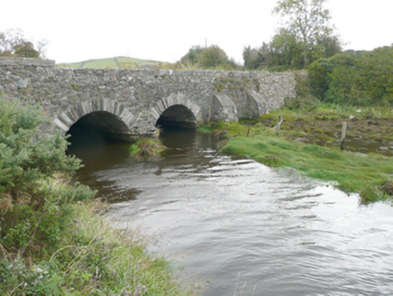 New BridgeBridge · 1718 yd
Explorer Tom New Bridge has a V-shaped stone nose pointing at the sea! Built around 1860, I wonder if the tide ever tried to bite…
 GreenfortGarden temple · 1.1 mi
Explorer Tom Greenfort’s garden temple is a tetrastyle Tuscan portico that was actually carried in from Ards House around 1965. It…
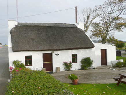 Kinard CottageHouse · 1.1 mi
Explorer Tom Kinard Cottage might have been next door to a blacksmith, which explains why the windows look so startled. Built around…
 CairnCairn, unclassified · 1.2 mi
Explorer Tom Cairn in Ballynashannagh was being removed when a stone burial box was reported on its north side. The account records…
 Cist in BallynashannaghCist · 1.2 mi
Explorer Tom Cist in Ballynashannagh sits there with its face completely down, refusing to make eye contact. I suspect it is just…
 Mapped graveyardGraveyard · 1.2 mi
Explorer Tom Another Mapped graveyard in County Donegal for us! If this place won the lotto, I bet it would buy a very fancy new…
 Portsalon Golf ClubGolf course · 1.4 mi
 PortsalonOfficial bathing water · 2.0 mi
Explorer Tom Portsalon has a beach so gracefully curved that it looks as if Lough Swilly used a compass and then showed off.…
 Wych Elm2.7 mi
Explorer Tom Wych Elm in Donegal is the site of a fierce fairy dispute over parking rights, as they argue about who gets the best…
More archaeology and monuments in County Donegal · All of County Donegal

What do you know about this place?Tap to add a comment or ask a question