
What is recorded here
Standing stone, Berneray is a standing or carved stone in Na h-Eileanan Siar, Scotland.
From the Geograph Britain and Ireland public picture record picture record
Places near here
Photo credits
- Julian Paren, Wikimedia Commons · CC BY-SA 2.0
- Sandy Gerrard, Wikimedia Commons · CC BY-SA 2.0
- Stephen Darlington, Wikimedia Commons · CC BY-SA 2.0
- Colin Smith, Wikimedia Commons · CC BY-SA 2.0
- Hugh Venables, Wikimedia Commons · CC BY-SA 2.0
- Calum McRoberts, Wikimedia Commons · CC BY-SA 2.0
- Richard Webb, Wikimedia Commons · CC BY-SA 2.0
- Eilidh Carr, Wikimedia Commons · CC BY-SA 2.0
- Oliver Dixon, Wikimedia Commons · CC BY-SA 2.0
 Berneray, Borve, Cladh MaolritheBurial Cairn (prehistoric) (possible), Burial Ground (medieval), Chapel (medieval) (possible), Standing Stone · 26 yd
 Cladh MaolritheArchaeological place · 27 yd
 Beinn a'ChlaidhMountain / peak · 44 yd
 Berneray, Ardmaree Stores, Forecasting StoneShop (20th Century) · 519 yd
 Loch Bhuirgh, BernerayBlackhouse (post Medieval), House · 548 yd
 Poll an OirBay · 744 yd
 Causeway Opening Commemoration StoneMemorial · 852 yd
 Cnoc BhuirghMountain / peak · 906 yd
 CracanaisHeadland · 1023 yd
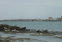 BeàrnaraighIsland · 1225 yd
 Eilean FuamIslet · 1435 yd
 Angus Macaskill memorialHeritage place · 1.1 mi
More archaeology and monuments in Na h-Eileanan Siar · All of Na h-Eileanan Siar
What do you know about this place?