What is recorded here
Some 175m WNW of Kilquain church (GA108-224----) and graveyard (GA108-224001-), in level grassland. Named ‘St Patrick’s well’ on the 1838 and 1945 editions of the OS 6-inch OS maps. The well occupies the NE sector of a low rectangular platform (13.5m E-W; 12.9m N-S; H 0.4m), which is defined by a scarp and surrounded by a shallow external fosse (Wth 1.4m). The well itself is delimited by a much-collapsed drystone-built circular wall (diam. 1.8m; H 0.15m; Wth 0.7m). On inspection, it was dry and the remains of a tree trunk lay across it. A hawthorn tree was growing to its E. Galway Archaeological Survey, UCG
Date of upload: 9 May 2023
Some 175m WNW of Kilquain church (GA108-224----) and graveyard (GA108-224001-), in level grassland. Named ‘St Patrick’s well’ on the 1838 and 1945 editions of the OS 6-inch OS maps. The well occupies the NE sector of a low rectangular platform (13.5m E-W; 12.9m N-S; H 0.4m), which is defined by a scarp and surrounded by a shallow external fosse (Wth 1.4m). The well itself is delimited by a much-collapsed…
From the National Monuments Service (Archaeological Survey of Ireland) record GA108-223
The monument record does not grant public access. Check the route and ask the landowner before entering private land.
- What survives
- Recorded monument
Places near here
Photo credits
- National Inventory of Architectural Heritage
- Mike Searle, Wikimedia Commons · CC BY-SA 2.0
- Dfoxvog, Wikimedia Commons · CC BY-SA 4.0
- Steve & Jemma Copley on Flickr, Wikimedia Commons · CC BY-SA 2.0
- Sitomon, Wikimedia Commons · CC BY-SA 2.0
Ecclesiastical enclosure in StowlinEcclesiastical enclosure · 202 yd Stowlin HouseHouse · 584 ydCatholic Church of Christ the KingChurch/chapel · 1020 ydLisnapeakFairy fort / earthen ringfort · 1489 ydBallymore CastleCastle, tower house · 3.9 miDerryhiveny CastleCastle · 3.9 miSilver Fir3.9 miBallymacegan IslandIsland · 4.0 miLong IslandIsland · 4.3 miRedmond HillMountain / peak · 4.4 miEuropean Yew4.7 miChurch HillMountain / peak · 4.8 mi
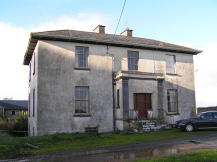 Stowlin HouseHouse · 584 yd
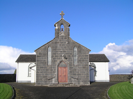 Catholic Church of Christ the KingChurch/chapel · 1020 ydLisnapeakFairy fort / earthen ringfort · 1489 yd
_(geograph_4071679).jpg/250px-Castles_of_Connacht-_Ballymore,_Galway_(1)_(geograph_4071679).jpg "Photo: Mike Searle, Wikimedia Commons · CC BY-SA 2.0") Ballymore CastleCastle, tower house · 3.9 mi
Ballymore CastleCastle, tower house · 3.9 mi Derryhiveny CastleCastle · 3.9 mi
 Silver Fir3.9 miBallymacegan IslandIsland · 4.0 miLong IslandIsland · 4.3 miRedmond HillMountain / peak · 4.4 mi
 European Yew4.7 miChurch HillMountain / peak · 4.8 mi
More archaeology and monuments in County Galway · All of County Galway
What do you know about this place?