
What is recorded here
Situated on the W bank of a stream. No visible surface trace of the 'St. Patrick's Shrine' recorded on the 1930 edition of the OS 6-inch map survives. It has been replaced by a modern shrine consisting of a statue of the saint and a water-filled trough, set in a circular concrete surround, which were erected in 1962.
The above description is derived from the published 'Archaeological Inventory of County Galway Vol. II - North Galway'. Compiled by Olive Alcock, Kathy de hÓra and Paul Gosling (Dublin: Stationery Office, 1999). In certain instances the entries have been revised and updated in the light of recent research.
Updated by: Olive Alcock
Date of revised upload: 8 August 2019
A local church or high cross; wider significance not recorded.
The monument record does not grant public access. Check the route and ask the landowner before entering private land.
- What survives
- Recorded monument
Places near here
 Church in ruinsChurch · 105 yd
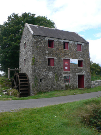 mill (water)mill (water) · 113 yd
 Castle (in ruins)Castle, unclassified · 946 yd
 Enclosure in CastletogherEnclosure · 947 yd
 Rook HillMountain / peak · 1234 yd
 Enclosure in BallyroeEnclosure · 1.3 mi
 Site of Ballyglass CastleCastle, unclassified · 1.9 mi
 Site of Killomaine Grave YardArchaeological place · 4.3 mi
 HawthornHawthorn · 8.5 mi
 Mount MaryMountain / peak · 9.4 mi
 Sally IslandIslet · 11 mi
 Aughrane WoodsForest · 12 mi
Other information
Photo: Credit not shown in the picture search · Rights wording not checked; contact us if this picture should be removed