What is recorded here
Situated on a steep W-facing slope in the valley of the NW-SE Clonough River, with the stream c. 10m to the W. Described as St. Michael's Well on the 1839 and 1940 eds of the OS 6-inch map, this is a natural spring that is a source of a short stream (L c. 10m) that joins the Clonough c. 10m to the S. There is no structure and there is no record of, or evidence of, veneration. Archaeological testing (08E0997) c. 50m to the N failed to produce any related material (Gregory 2011).
Situated on a steep W-facing slope in the valley of the NW-SE Clonough River, with the stream c. 10m to the W. Described as St. Michael's Well on the 1839 and 1940 eds of the OS 6-inch map, this is a natural spring that is a source of a short stream (L c. 10m) that joins the Clonough c. 10m to the S. There is no structure and there is no record of, or evidence of, veneration. Archaeological testing (08E0997) c.…
From the National Monuments Service (Archaeological Survey of Ireland) record WX003-030
The monument record does not grant public access. Check the route and ask the landowner before entering private land.
- What survives
- Recorded monument
Places near here
Photo credits
- National Inventory of Architectural Heritage
- Sarah777 at English Wikipedia, Wikimedia Commons · Public domain
- Sarah777, Wikimedia Commons · CC BY-SA 2.0
- Ian Brooker and David Kleinig, Wikimedia Commons · CC BY 3.0 au
- surrealpenguin, Wikimedia Commons · CC BY-SA 2.0
- 瑞丽江的河水, Wikimedia Commons · CC BY-SA 4.0
- en:User:Poccil (SVG file), Wikimedia Commons · Public domain
- Smirkybec, Wikimedia Commons · CC BY-SA 4.0
- Ryanforsyth9, Wikimedia Commons · CC BY-SA 4.0
 Hydepark HouseFarmyard complex · 801 yd
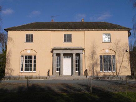 Hydepark HouseCountry house · 847 ydFulacht fia in BallyellinFulacht fia · 996 ydFulacht fia in BallyellinFulacht fia · 1044 yd
 Tara HillMountain / peak · 2.8 mi
 Arklow RockMountain / peak · 3.1 mi
 Johnston's gum3.7 mi
 Persian Walnut3.7 mi
 The CoveBeach / strand · 3.8 mi
 Battle of ArklowBattle · 4.1 mi
 Market HouseHeritage attraction · 5.8 mi
 1798 MonumentMemorial · 6.1 mi
More archaeology and monuments in County Wexford · All of County Wexford
What do you know about this place?