What is recorded here
Lower courses early 19th century church: replacement for earlier chapel (CO132-015001-) to E, indicated "in Ruins" on OS 6-inch map (1842), of which there are no surface remains. Church T-shaped in ground plan; nave orientated NW-SE (int. L c. 28.2m; int. Wth 6.9m; wall thickness 0.72m; wall H c. 1.25m); curving recess in internal SE wall accommodated altar. Transepts SE end (int. L 7.3m; int. Wth 6.9m). Memorial plaques on internal walls. Bell tower at entrance to church and late 19th/20th century graveyard, with date plaque of 1822.
The above description is derived from the published 'Archaeological Inventory of County Cork. Volume 1: West Cork' (Dublin: Stationery Office, 1992). In certain instances the entries have been revised and updated in the light of recent research.
Date of upload/revision: 14 January 2009
The monument record does not grant public access. Check the route and ask the landowner before entering private land.
- What survives
- Recorded monument
Places near here
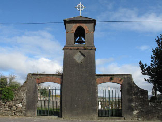 St. Mary's Churchbell tower/stand · 6 yd
 Church in Killeenleagh (carbery West (w.d) By.)Church · 152 yd
 Man-made underground passage in Killeenleagh (carbery West (w.d) By.)Man-made underground passage · 216 yd
 Caheragh Burial GroundGraveyard · 1126 yd
 Ballyourane Castle (in Ruins)Castle, unclassified · 1.3 mi
 Lissangle Castle (Site of)Castle, unclassified · 1.9 mi
 Moyny Bridge WalkWalking route · 2.7 mi
 Drimoleague Heritage Loop WalkWalking route · 3.0 mi
 Mount KidMountain / peak · 3.7 mi
 Francis O'Neill PlaqueMemorial · 4.2 mi
 Milane HillMountain / peak · 6.3 mi
 Monterey CypressMonterey Cypress · 6.4 mi