
What is recorded here
In the field immediately NW of the medieval church of Ullard (KK025-038001-) on an E-facing slope, in pasture. The holy well 70m to the NNW of the church. There are two bullaun stones (KK025-038006-; KK025-038008-) 21m and 19m to the SSE and S respectively. The well is dedicated to St Fiachra, who according to tradition founded a church here in the latter part of the 6th-century (Vigors 1893, 257). According to Vigors (ibid., 258), the water from this well reputedly had the power to prevent death by drowning. According to O’Leary (1948, 25), "On the 8th of February [the saint’s feast day] many of the people, old and young, still make their penitential rounds at the Holy Well and perform their devotions at the church, where they finish by placing crosses of twig in the east window in honour of St. Fiachra." Seldom less than 30, and this year 1948, sixty pilgrims made their rounds, 'speaking to no one, only to God and poor St. Feeragh," as one old pilgrim puts it'. The holy well is located at the SW end of a long, rectangular, stone-lined channel (L 11.2m; Wth 1.6m) aligned NE-SW. The holy well, which contains the spring, is a circular, stone-lined structure (D 1.14m; diam. 1.10m; T 0.16m; diam. of hole 0.12m), covered with a flat rectangular slab. A millstone (diam. 0.8m, 0.4m of which projects northward from the retaining wall) has been built into the S side of the well opening, where it functions as a step down to the water. See attached photographs:
KK025-038003-_01 Well from NE with bullaun stone (KK025-038008-) and church (KK025-038001-) in background
KK025-038003-_02 Reused millstone on S side of retaining wall of well
Compiled by: Jean Farrelly
Date of upload: 15 February 2017
In the field immediately NW of the medieval church of Ullard (KK025-038001-) on an E-facing slope, in pasture. The holy well 70m to the NNW of the church. There are two bullaun stones (KK025-038006-; KK025-038008-) 21m and 19m to the SSE and S respectively. The well is dedicated to St Fiachra, who according to tradition founded a church here in the latter part of the 6th-century (Vigors 1893, 257). According to…
From the National Monuments Service (Archaeological Survey of Ireland) record KK025-038003
The monument record does not grant public access. Check the route and ask the landowner before entering private land.
- What survives
- Recorded monument
Places near here
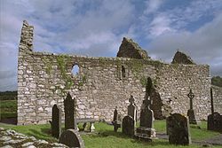 Church (in ruins)Church · 83 yd
 Font in UllardFont · 85 yd
 Stone CrossCross, High cross · 85 yd
 Ullard HouseHouse · 142 yd
 Hybrid Black Poplar1506 yd
 Sweet Chestnut1.1 mi
 The Barrow WayVisitor information · 1.6 mi
 The PoundMemorial · 2.8 mi
 General Thomas CloneyMemorial · 2.8 mi
 Keating's WellSpring · 2.9 mi
 Tinahinch Castle (in Ruins)Castle, tower house · 3.2 mi
 CroghanMountain / peak · 4.1 mi
Pictures: Andreas F. Borchert, Wikimedia Commons · CC BY-SA 4.0; A.-K. D., Wikimedia Commons · CC BY-SA 4.0; A.-K. D., Wikimedia Commons · CC0; National Inventory of Architectural Heritage; Rasbak, Wikimedia Commons · CC BY-SA 3.0; Miguel Angel Masegosa Martínez, Wikimedia Commons · CC BY 2.0; Colin Park, Geograph · CC BY-SA 2.0; Humphrey Bolton, Wikimedia Commons · CC BY-SA 2.0; Alex Passmore, Geograph · CC BY-SA 2.0
More archaeology and monuments in County Kilkenny · All of County Kilkenny
What do you know about this place?