What is recorded here
In pasture, in lowlying ground bordering the E bank of the Abbey River. The location is marked by a small stand of ash trees. This holy well is not indicated on the 1836 OS 6-inch map but is named as ‘St. Columbkille’s Well’ on the 25-inch plan and on the 1952-4 OS 6-inch map. It was recorded in the 1930's as: 'St.…
Read the whole record
From the National Monuments Service (Archaeological Survey of Ireland) record DG107-041
Places near here
Photo credits
- National Inventory of Architectural Heritage
- Maker not stated on source page, uk.pinterest.com
- Maker not stated on source page, www.pinterest.com
- Maker not stated on source page, commons.wikimedia.org
- Maker not stated on source page, www.flickr.com
- Kenneth Allen, Geograph · CC BY-SA 2.0
- Kenneth Allen, Wikimedia Commons · CC BY-SA 2.0
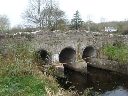 Tullymore BridgeBridge · 793 yd
Explorer Tom Tullymore Bridge puts a gentle hump in the road above the Two Mile Water. Its three arches date from around 1800, while…
 Megalithic tomb in LegaltanMegalithic tomb · 969 yd
Explorer Tom The Megalithic tomb in Legaltan sits right by Lough Legaltan, where it might actually get flooded if the water level…
 Tullymore Third Ring-BarrowBarrow, ring-barrow · 1467 yd
Explorer Tom Tullymore Third Ring-Barrow sits on the edge of a ridge with views over the Erne valley. It’s twelve metres across…
 Tullymore Middle Ring-BarrowBarrow, ring-barrow · 1482 yd
Explorer Tom Tullymore Middle Ring-Barrow is a neat circular dip with a bank and a causeway to the southeast. It’s just a slightly…
 Tullymore Western Ring-BarrowBarrow, ring-barrow · 1485 yd
Explorer Tom Tullymore Western Ring-Barrow is a six-metre circular dip with a bank and a western causeway, sitting right next to its…
 Dicey Reilly’sPub · 1748 yd
Explorer Tom Dicey Reilly’s is on Market Street, so expect a crowd that knows exactly which side of the argument they're winning.…
 Max BarPub · 1750 yd
Explorer Tom Max Bar is also on Market Street, right next door to other pubs, suggesting a fierce rivalry over who has the best…
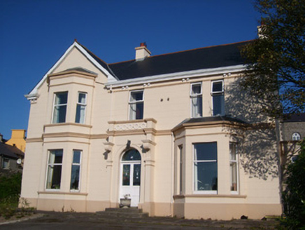 Kilbarron HousePresbytery/parochial/curate's house · 1751 yd
Explorer Tom Kilbarron House has these silly little circular motifs on its porch frieze. I wonder if they were meant to look like…
 Shannon's CornerRestaurant · 1.0 mi
Explorer Tom Shannon's Corner restaurant in Donegal would bring a very unremarkable cake to a party because it’s terrified of being…
 Sean Óg’sPub · 1.0 mi
Explorer Tom Sean Óg’s is on Market Street, and Sean Óg means young Sean, so maybe the owner is younger than his name suggests. Ask…
 Rory GallagherMemorial · 1.1 mi
Explorer Tom Rory Gallagher memorial has a dog sitting in charge of everything, looking like it’s got more authority than the local…
 St Anne's Church GraveyardGraveyard · 1.1 mi
Explorer Tom “St Anne's Church Graveyard” in Ballyshannon has a fierce rivalry with the cathedral down the road because it refuses…
More archaeology and monuments in County Donegal · All of County Donegal

What do you know about this place?Tap to add a comment or ask a question