What is recorded here
St. Begnet's Well in the town and parish of Dalkey is situated to the SE of Castle Street in an area occupied by the car park, 180m SSE of St Begnet's church (DU023-023002-) and graveyard (DU023-023020-). The Urban Survey of Dublin recorded that 'the site of this well is pointed out behind the street frontage at the southeast end of Castle Street (Bradley et. al. 1988, 245). Annotated 'St. Begnet's Well' on the 1837 ed. OSi 6-inch map and as 'Well (Site of)' on the Cassini ed. OSi 6-inch map. No visible surface trace (Ó Danachair 1958, 84).
St. Begnet's Well in the town and parish of Dalkey is situated to the SE of Castle Street in an area occupied by the car park, 180m SSE of St Begnet's church (DU023-023002-) and graveyard (DU023-023020-). The Urban Survey of Dublin recorded that 'the site of this well is pointed out behind the street frontage at the southeast end of Castle Street (Bradley et. al. 1988, 245). Annotated 'St. Begnet's Well' on the…
From the National Monuments Service (Archaeological Survey of Ireland) record DU023-023013
The monument record does not grant public access. Check the route and ask the landowner before entering private land.
- What survives
- Recorded monument
Places near here
Photo credits
- Palanitboy, Wikimedia Commons · CC BY-SA 4.0
- Mike Searle, Wikimedia Commons · CC BY-SA 2.0
- Mike Searle, Geograph · CC BY-SA 2.0
- JacK93, Wikimedia Commons · CC BY-SA 4.0
- The original uploader was Irishpunktom at English Wikipedia ., Wikimedia Commons · CC BY-SA 3.0
- JP, Geograph · CC BY-SA 2.0
- Aleks Scholz, Geograph · CC BY-SA 2.0
- Nick Lansley, Wikimedia Commons · CC BY-SA 3.0
- Gareth James, Geograph · CC BY-SA 2.0
- Colin Park, Geograph · CC BY-SA 2.0
- David Dixon, Geograph · CC BY-SA 2.0
- John Fahy, Wikimedia Commons · CC BY-SA 3.0
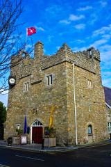 Dalkey CastleFortified town house and castle · 168 yd
 CastleCastle, tower house · 169 yd
 CastleCastle, unclassified · 181 yd
 Church in DalkeyChurch · 200 yd
 Dalkey HillMountain / peak · 834 yd
 Hawk CliffCliff · 1026 yd
 Hawk CliffCliff · 1043 yd
 St Begnets ChurchChurch · 1421 yd
 White Rock, Killiney BeachBeach / strand · 1454 yd
 Mapas MonumentHeritage attraction · 1491 yd
 Martello Tower1500 yd
 Dalkey IslandIslet · 1549 yd
More archaeology and monuments in County Dublin · All of County Dublin
What do you know about this place?