
Places near here
Photo credits
- Kenneth Allen, Geograph · CC BY-SA 2.0
- National Inventory of Architectural Heritage
- Djedi Guy, Wikimedia Commons · CC BY-SA 4.0
- GTD Aquitaine, Wikimedia Commons · Public domain
- Kmcnamee, Wikimedia Commons · CC BY-SA 4.0
- Zxcode, Wikimedia Commons · CC BY-SA 3.0
- Zxcode / Wikimedia Commons, commons.wikimedia.org
 The ThatchHouse · 1429 yd
Explorer Tom The Thatch in Knoxspark is a pub that lost its roof but kept its attitude. A local cow once tried to buy it with a…
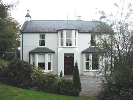 Arrow LodgeRectory/glebe/vicarage/curate's house · 1506 yd
Explorer Tom Arrow Lodge in Knoxspark would describe itself as a well-proportioned house with broached bay windows that see all.…
 weir1687 yd
Explorer Tom Weir in Kilboglashy nearly got famous when a tourist mistook it for a slide into the afterlife. It generates…
 Saint Brigid's Catholic ChurchChurch/chapel · 1735 yd
Explorer Tom Saint Brigid's Catholic Church in Halfquarter probably polishes its stained glass windows when nobody is looking just…
 Avena HouseMiller's house · 1752 yd
Explorer Tom Avena House in Knockmuldoney is a miller’s house with Tudorbethan detailing that really knows its place. It’s had a…
 Battle of CollooneyBattle · 1.1 mi
Explorer Tom The Battle of Collooney in County Sligo took about four cups of tea to build up the energy needed for the fighting, and…
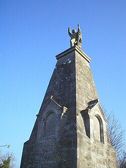
 Teeling MonumentMemorial · 1.1 mi
Explorer Tom The Teeling Monument refuses to fall down because it’s too proud to admit the ground beneath it is just soft mud. It…
 Battlefield in Carricknagat (leyny By.),rinn (leyny By.),bleachgreen,collooney,ardcottenBattlefield · 1.1 mi
Explorer Tom Battlefield in Carricknagat survived a massive storm by just staying put, which is impressive for a spot with such a…
 Ballisodare GAAGAA ground · 1.1 mi
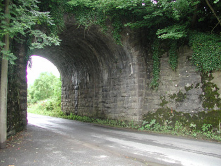 bridge1.1 mi
Explorer Tom Bridge in Bleachgreen is haunted by a fiddler who played all night and never stopped, which explains the weird energy…
 Collooney Railway StationRailway station · 1.2 mi
Explorer Tom Collooney Railway Station would tell its younger self to stop worrying about the canopy and oculus, because they look…
 Owenmore Gaels GAA pitchGAA ground · 1.8 mi
More mountains and hills in County Sligo · All of County Sligo

What do you know about this place?Tap to add a comment or ask a question