
What is recorded here
South Uist, Eriskay Causeway is a causeway in Na h-Eileanan Siar, Scotland.
From the Historic Environment Scotland record 277181
The historic-place record does not grant public access. Check current conditions and ownership before entering land or a building.
Places near here
 Rubh' an t-Seana BhallaHeadland · 663 yd
 Eriskay Church InteriorChurch, cross or graveyard · 702 yd
 Commemorative StoneStanding or carved stone · 755 yd
 Closeup of Commemorative StoneStanding or carved stone · 775 yd
 Rubha nan GobharHeadland · 863 yd
 A rocky beach, LudagBeach · 1118 yd
 Ludag PierHeritage place · 1141 yd
 Eriskay Cemetery at the edge of the seaChurch, cross or graveyard · 1440 yd
 Beach at Cul-phortBeach · 1.2 mi
 Beinn SgritheannMountain / peak · 1.4 mi
 250th Anniversary of Charles Edward Stewart's Landing CairnMemorial · 1.4 mi
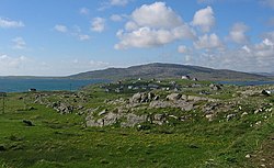 ÈirisgeighIsland · 1.6 mi
Pictures: Tim Glover, Wikimedia Commons · CC BY-SA 2.0; Howard Teale, Wikimedia Commons · CC BY-SA 2.0; Dave Fergusson, Wikimedia Commons · CC BY-SA 2.0; Gordon Brown, Wikimedia Commons · CC BY-SA 2.0; Richard Webb, Wikimedia Commons · CC BY-SA 2.0; Colin Smith, Wikimedia Commons · CC BY-SA 2.0; Thomas Dick, Wikimedia Commons · CC BY-SA 2.0; Mipmapped, Wikimedia Commons · CC BY-SA 3.0; Barbara Carr, Wikimedia Commons · CC BY-SA 2.0
More historic places in Na h-Eileanan Siar · All of Na h-Eileanan Siar
What do you know about this place?